Goochland County, Virginia
| Goochland County, Virginia | ||
|---|---|---|

Goochland County Courthouse
|
||
|
||
 Location in the U.S. state of Virginia |
||
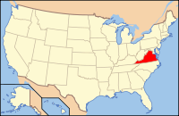
 Virginia's location in the U.S. |
||
| Founded | 1728 | |
| Named for | Sir William Gooch | |
| Seat | Goochland | |
| Area | ||
| • Total | 290 sq mi (751 km2) | |
| • Land | 281 sq mi (728 km2) | |
| • Water | 8 sq mi (21 km2), 2.9% | |
| Population (est.) | ||
| • (2015) | 22,253 | |
| • Density | 77/sq mi (30/km²) | |
| Congressional district | 7th | |
| Time zone | Eastern: UTC-5/-4 | |
| Website | www |
|
Goochland County is a county located in the Commonwealth of Virginia. As of the 2010 census, the population was 21,717. Its county seat is Goochland.
Goochland County is included in the Greater Richmond Region
Native Americans had lived along the waterways for several thousand years. Siouan-speaking tribes were the ones encountered by English colonists. Their numbers were sharply reduced by European infectious diseases to which they had no immunity, which caused widespread social disruption.
In 1634, the colonial government organized the territory of Virginia into eight shires, to be governed as shires in England. Henrico was one of these shires.
Goochland was founded in 1728 as the first county formed from Henrico shire, followed by Chesterfield County in 1749. Goochland originally included all of the land from Tuckahoe Creek, on both sides of the James River, west as far as the Blue Ridge Mountains.
Goochland was named for Sir William Gooch, 1st Baronet, the royal lieutenant governor from 1727 to 1749, at which time the nominal governor, the Earl of Albemarle, remained in England. As acting royal governor, Gooch promoted settlement of the Virginia backcountry as a means to insulate the Virginia colony from Native American and New France settlements in the Ohio Country
...
Wikipedia

