Chesterfield County, Virginia
| Chesterfield County, Virginia | |||
|---|---|---|---|
| County | |||

Chesterfield County Courthouse
|
|||
|
|||
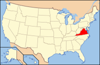
 Location in the U.S. state of Virginia |
|||
 Virginia's location in the U.S. |
|||
| Founded | May 25, 1749 | ||
| Named for | Philip Stanhope, 4th Earl of Chesterfield | ||
| Seat | Chesterfield Court House | ||
| Largest community | Chester | ||
| Area | |||
| • Total | 437 sq mi (1,132 km2) | ||
| • Land | 423 sq mi (1,096 km2) | ||
| • Water | 14 sq mi (36 km2), 3.1% | ||
| Population (est.) | |||
| • (2015) | 335,687 | ||
| • Density | 742/sq mi (286.5/km²) | ||
| Congressional districts | 4th, 7th | ||
| Time zone | Eastern: UTC-5/-4 | ||
| Website | www |
||
Chesterfield County is a United States county located just south of Richmond in the Commonwealth of Virginia. The county borders are primarily defined by the James River to the north, and the Appomattox River to the South. Its county seat is Chesterfield Court House.
Chesterfield County was formed in 1749 from parts of Henrico County. It was named for Philip Stanhope, 4th Earl of Chesterfield, a prominent English statesman who had been the Lord Lieutenant of Ireland.
As of the 2010 census, the population was 316,236, making it the third-most populous county in Virginia (behind Fairfax County and Prince William County, respectively). In July 2014, the population was estimated to be 330,043. Chesterfield County is part of the Greater Richmond Region, and much of the northern portion of the county is referred to as Richmond's "South Side".
During the early 17th century, shortly after the settlement of Jamestown in 1607, English settlers and explorers began settling other areas. One of the more progressive developments in the colony was Henricus, founded under the guidance of Sir Thomas Dale. It was to include a college to help educate Virginia Indians, as well as the children of settlers. Dale was accompanied by men known as the "Hammours". These veterans of the Low Country wars were heavily armed and better trained than settlers of Jamestown.
...
Wikipedia


