Bukit Panjang
| Bukit Panjang | ||||||
|---|---|---|---|---|---|---|
| Planning Area and HDB Town | ||||||
| Other transcription(s) | ||||||
| • Chinese | 武吉班让 | |||||
| • Pinyin | Wǔjíbānràng | |||||
| • Hokkien | Bú-kiat Pan-jâng | |||||
| • Malay | Bukit Panjang | |||||
| • Tamil | பக்கிட் பஞ்சாங் | |||||
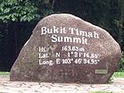
From top left to right: HDB flats in Bukit Panjang, Senja-Cashew Community Club with HDB flats in the background, Summit of Bukit Timah Hill, Zhenghua Community Club
|
||||||
| Location of Bukit Panjang within Singapore | ||||||
| Coordinates: 1°22′51.00″N 103°45′45.00″E / 1.3808333°N 103.7625000°E | ||||||
| Country |
|
|||||
| Region |
|
|||||
| CDC | ||||||
| Town council |
|
|||||
| Constituencies | ||||||
| Government | ||||||
| • Mayor |
North West CDC |
|||||
| • Members of Parliament |
Bukit Panjang SMC
Holland-Bukit Timah GRC |
|||||
| Area | ||||||
| • Total | 8.99 km2 (3.47 sq mi) | |||||
| • Residential | 2.19 km2 (0.85 sq mi) | |||||
| Population (2015) | ||||||
| • Total | 139,030 | |||||
| • Density | 15,000/km2 (40,000/sq mi) | |||||
| Demonym(s) |
Official
Colloquial
|
|||||
| Ethnic groups | ||||||
| • Chinese | 103,280 | |||||
| • Malays | 22,230 | |||||
| • Indians | 10,300 | |||||
| • Others | 3,210 | |||||
| Postal districts | 21, 23 | |||||
| Dwelling units | 34,463 | |||||
| Projected ultimate | 44,000 | |||||
North West CDC
Bukit Panjang SMC
Holland-Bukit Timah GRC
Official
Colloquial
Bukit Panjang (Chinese: 武吉班让, Tamil: பக்கிட் பஞ்சாங்), formerly known as Zhenghua and often abbreviated as Bt Panjang, is a planning area and residential town located in the West Region of Singapore. A portion of this town is situated on a low-lying elongated hill. The planning area is bounded by Bukit Batok to the west, Choa Chu Kang to the northwest, Sungei Kadut to the north, the Central Water Catchment to the east and Bukit Timah to the south. Bukit Panjang New Town is located at the northern portion of the planning area. Bukit Panjang has an average elevation of 36m/118 ft.
Bukit in the Malay Language means "hill" and Panjang means "long". Bukit Panjang literally means "long hill" which gets its name from the long range of high hills which ends in Bukit Timah to the south.
At the height of the movement to change place names in Singapore to Mandarin ones using hanyu pinyin romanization, the new town to be built in the area was initially known as Zhenghua (正华), after the Pinyinised version of "Cheng Hwa", which was derived from the old road Jalan Cheng Hwa. along with Yishun (义顺) for Nee Soon, and Zhujiao market for tek kha (竹脚) market in Kandang Kerbau. The trading of old dialect names which have gained common currency for unfamiliar, Mandarin ones was not well received by the public, and Bukit Panjang was quickly reinstated. However, the name Zhenghua is preserved in the name of the flyover between Bukit Panjang Road and the Bukit Timah Expressway as well as the Zhenghua Park.
...
Wikipedia


