Bellwood, IL
| Bellwood, Illinois | |
| Village of Bellwood | |
| Village | |
| Motto: "Your Family Is Our Future" | |
| Country | United States |
|---|---|
| State | Illinois |
| County | Cook |
| Township | Proviso |
| Coordinates | 41°52′59″N 87°52′35″W / 41.882924°N 87.876428°WCoordinates: 41°52′59″N 87°52′35″W / 41.882924°N 87.876428°W |
| Area | 2.40 sq mi (6.22 km2) |
| - land | 2.40 sq mi (6 km2) |
| - water | 0.00 sq mi (0 km2), 0% |
| Population | 19,071 (2010) |
| Density | 7,946.3/sq mi (3,068.1/km2) |
| Incorporated | 1900 |
| Mayor | Frank A. Pasquale |
| Timezone | CST (UTC-6) |
| - summer (DST) | CDT (UTC-5) |
| Postal code | 60104 |
| Area code | 708 |
|
Location in Cook County and the state of Illinois.
|
|
|
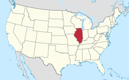
Location of Illinois in the United States
|
|
|
Website: www |
|
Bellwood is a village in Proviso Township, Cook County, Illinois, United States. Located 13 miles (21 km) west of Chicago's downtown Loop, the village of Bellwood is bounded by the Eisenhower Expressway (south), the Proviso yards of the Union Pacific Railroad (north), and the suburbs of Maywood (east) and Hillside and Berkeley (west). The population was 19,071 at the 2010 census.
Bellwood was incorporated on May 21, 1900.
Bellwood is located at 41°52′59″N 87°52′35″W / 41.88306°N 87.87639°W (41.882924, -87.876428).
According to the 2010 census, Bellwood has a total area of 2.4 square miles (6.22 km2), all land.
As of the census of 2000, there were 20,535 people, 6,440 households, and 5,100 families residing in the village. The population density was 8,608.0 people per square mile (3,317.4/km²). There were 6,683 housing units at an average density of 2,801.4 per square mile (1,079.6/km²). The racial makeup of the village was 11.75% White, 81.73% African American, 0.24% Native American, 0.96% Asian, 0.02% Pacific Islander, 3.79% from other races, and 1.51% from two or more races. Hispanic or Latino of any race were 7.94% of the population.
...
Wikipedia


