Maywood, Illinois
| Maywood, Illinois | |
| Village | |
|
Masonic Temple
|
|
| Motto: "Village of Eternal Light" | |
| Country | United States |
|---|---|
| State | Illinois |
| County | Cook |
| Township | Proviso |
| Coordinates | 41°52′52″N 87°50′36″W / 41.88111°N 87.84333°WCoordinates: 41°52′52″N 87°50′36″W / 41.88111°N 87.84333°W |
| Area | 2.72 sq mi (7 km2) |
| - land | 2.72 sq mi (7 km2) |
| - water | 0.00 sq mi (0 km2) |
| Population | 24,090 (2010) |
| Density | 8,856.6/sq mi (3,420/km2) |
| Timezone | CST (UTC-6) |
| - summer (DST) | CDT (UTC-5) |
| Postal code | 60153, 60154, 60155 |
| Area code | 708 |
|
Location in Cook County and the state of Illinois.
|
|
|
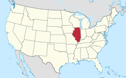
Location of Illinois in the United States
|
|
|
Website: www |
|
Maywood is a village in Proviso Township, Cook County, Illinois, United States. It was founded on April 6, 1869, and organized October 22, 1881. The population was 24,090 at the 2010 United States Census.
Maywood is a village in Cook County, Illinois, a suburb of Chicago,10 miles (16 km) west of downtown Chicago. Interstate 290, the Eisenhower Expressway, bisects (north and south) the town as it goes from Chicago west to join Interstate 294, the Tri-State Tollway, in Hillside. Maywood is located between O'Hare and Midway airports.
There are many century-old homes in relatively unaltered condition, and Maywood boasts 2 homes and properties listed on the National Register of Historic Places.
At one time there were two airports in Maywood. One was on the location where the Loyola University Medical Center is today, at the southwest corner of First Avenue and Roosevelt Road. It was the airfield used by Charles Lindbergh during his days as an airmail pilot. Checkerboard Field was on the southeastern corner of that intersection and was a private field. It is now a forest preserve meadow. There was some apparent consolidation of the fields in later years. The current Hines Veterans Hospital's long narrow building is built on the foundation of the former grandstand for the automobile board racetrack from many years ago; Barney Oldfield raced on the track.
According to the 2010 census, Maywood has a total area of 2.72 square miles (7.04 km2), all land.
Neighboring villages are Broadview to the south, Forest Park and River Forest to the east, Melrose Park to the north, and Bellwood to the west.
...
Wikipedia


