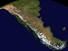
Andean highland
| Andes | |
|---|---|
| Andean Mountains | |

|
|
| Highest point | |
| Peak | Aconcagua (Las Heras Department, Mendoza, Argentina) |
| Elevation | 6,961 m (22,838 ft) |
| Coordinates | 32°39′10″S 70°0′40″W / 32.65278°S 70.01111°WCoordinates: 32°39′10″S 70°0′40″W / 32.65278°S 70.01111°W |
| Dimensions | |
| Length | 7,000 km (4,300 mi) |
| Width | 500 km (310 mi) |
| Naming | |
| Native name | Quechua: Anti(s/kuna) |
| Geography | |
| Countries |
List
|
The Andes or Andean Mountains (Spanish: Cordillera de los Andes) are the longest continental mountain range in the world. They are a continuous range of highlands along the western edge of South America. This range is about 7,000 km (4,300 mi) long, about 200 to 700 km (120 to 430 mi) wide (widest between 18° south and 20° south latitude), and of an average height of about 4,000 m (13,000 ft). The Andes extend from north to south through seven South American countries: Venezuela, Colombia, Ecuador, Peru, Bolivia, Argentina and Chile.
Along their length, the Andes are split into several ranges, which are separated by intermediate depressions. The Andes are the location of several high plateaus – some of which host major cities, such as Quito, Bogotá, Arequipa, Medellín, Sucre, Mérida and La Paz. The Altiplano plateau is the world's second-highest after the Tibetan plateau. These ranges are in turn grouped into three major divisions based on climate: the Tropical Andes, the Dry Andes, and the Wet Andes.
...
Wikipedia

