Amlikon-Bissegg
| Amlikon-Bissegg | ||
|---|---|---|

Amlikon village
|
||
|
||
| Coordinates: 47°34′N 9°3′E / 47.567°N 9.050°ECoordinates: 47°34′N 9°3′E / 47.567°N 9.050°E | ||
| Country | Switzerland | |
| Canton | Thurgau | |
| District | Weinfelden | |
| Area | ||
| • Total | 14.43 km2 (5.57 sq mi) | |
| Elevation | 422 m (1,385 ft) | |
| Population (Dec 2015) | ||
| • Total | 1,323 | |
| • Density | 92/km2 (240/sq mi) | |
| Postal code | 8514 | |
| SFOS number | 4881 | |
| Localities | Amlikon, Bissegg, Holzhäusern, Hünikon, Junkholz, Griesenberg, Altenburg, Bänikon, Fimmelsberg, Holzhof, Leutmerken, Tümpfel, Strohwilen | |
| Surrounded by | Affeltrangen, Bussnang, Hüttlingen, Märstetten, Müllheim, Thundorf, Weinfelden, Wigoltingen | |
| Website |
www SFSO statistics |
|
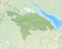
Amlikon-Bissegg is a municipality in the district of Weinfelden in the canton of Thurgau in Switzerland.
The municipality was created on 1 January 1995 by a merger of Amlikon, Bissegg, Griesenberg and Strohwilen.
Amlikon village is first mentioned in 1282. The hamlet of Bissegg is first mentioned in 1324 as Bynssegge. Bissegg also includes the hamlets of Holzhäusern (mentioned in 1397 as Holtzhusern), Hünikon (mentioned in 857 as Huninchova) and Junkholz (mentioned in 1324 as Junkholtz). The village of Griesenberg is first mentioned in 1256 as Griessinberc and it also includes the hamlet of Fimmelsberg (mentioned in 1228 as Vilmarsperc) as well as other hamlets.
During the High Middle Ages it was part of the lands of the Baron of Bussnang. From the mid-13th Century until 1798, it was part of the court of Griesenberg, which came from a side line of the Bussnang family. Amlikon has always been part of the parish of Bussnang. The ferry over the Rhine in Amlikon, was first mentioned in the 14th Century. It was replaced around 1727 by a bridge. The flood of 15 June 1910 destroyed the covered bridge that had been built in 1821. It was replaced in 1911-12 by an iron structure, which was replaced in 1995 by a concrete bridge. The municipality lies on both sides of the Thur River.
Until the 19th Century the main economic activities were grain cultivation in a three-field system and hemp production. This was mostly replaced in the 19th Century by cattle and dairy farming. The first cheese factory was built in 1908. Wine grapes are cultivated today. In the 19th Century there was an oil press. The steep lane to the village was replaced in 1832 by the S-shaped village street. At the turn of the 20th Century there were several local embroidery shops. However, larger factories did not permanently settle in the village.
Much of the village was owned by the Abbey of St. Gallen. During the High Middle Ages it was under the influence of the Baron of Bussnang. Between the mid-13th Century to 1798, it was under the court of the Griesenberg family, which was a side branch of the Bussnang family. It was always part of the parish of Bussnang, until in 1857 Bissegg and Junkholz became part of the Reformed parish of Leutmerken.
...
Wikipedia


