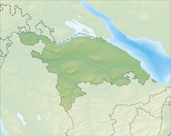
Müllheim, Switzerland
| Müllheim | ||
|---|---|---|
 |
||
|
||
| Coordinates: 47°36′N 9°0′E / 47.600°N 9.000°ECoordinates: 47°36′N 9°0′E / 47.600°N 9.000°E | ||
| Country | Switzerland | |
| Canton | Thurgau | |
| District | Frauenfeld | |
| Area | ||
| • Total | 8.73 km2 (3.37 sq mi) | |
| Elevation | 413 m (1,355 ft) | |
| Population (Dec 2015) | ||
| • Total | 2,884 | |
| • Density | 330/km2 (860/sq mi) | |
| Postal code | 8555 | |
| SFOS number | 4831 | |
| Surrounded by | Amlikon-Bissegg, Homburg, Hüttlingen, Pfyn, Wigoltingen | |
| Website |
www SFSO statistics |
|
Müllheim is a municipality in Frauenfeld District in the canton of Thurgau in Switzerland.
Müllheim is first mentioned in 1254 as Mulhain. In the 13th and 14th Centuries the Ministerialis (unfree knights in the service of a feudal overlord) family of Müllheim was mentioned. Initially the Counts of Kyburg owned the bailiwick of Müllheim. When that line died out, the Habsburgs took over. Reichenau Abbey bought the rights over the village in 1460. The abbey and its successors (between 1540-1798 the Bishop of Constance) were the judicial rulers and landlords of the village. The municipality had the right to impose fines and light corporal punishment
The village church was probably first built, as part of Pfyn parish, around 1340. It belonged to the Langenhart parish until 1483 and then to Hüttlingen. In 1528 the Protestant Reformation entered the village and many of the villagers converted. In 1540 the rights to appoint the village priest went to the Bishop of Constance. In 1804 those rights went to the Canton Thurgau, and in 1830 to the local parish. In 1607 the Catholic Mass was once again allowed in the village. The church of St. Verena was then used by both denominations, until the construction of the Catholic Church in 1967. In the course of the 20th Century, the portion of the inhabitants who follow the Swiss Reformed Church has increased. By the turn of the 21st Century it was about half of the population.
...
Wikipedia


