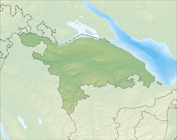
Hüttlingen, Switzerland
| Hüttlingen | ||
|---|---|---|
|
||
| Coordinates: 47°35′N 8°59′E / 47.583°N 8.983°ECoordinates: 47°35′N 8°59′E / 47.583°N 8.983°E | ||
| Country | Switzerland | |
| Canton | Thurgau | |
| District | Frauenfeld | |
| Area | ||
| • Total | 11.6 km2 (4.5 sq mi) | |
| Elevation | 411 m (1,348 ft) | |
| Population (Dec 2015) | ||
| • Total | 830 | |
| • Density | 72/km2 (190/sq mi) | |
| Postal code | 8553 | |
| SFOS number | 4590 | |
| Surrounded by | Amlikon-Bissegg, Felben-Wellhausen, Müllheim, Pfyn, Thundorf, Wigoltingen | |
| Website |
www SFSO statistics |
|
Hüttlingen is a municipality in the district of Frauenfeld, in the canton of Thurgau in Switzerland.
Hüttlingen is first mentioned in 1336 as Hutlingen. During the Early Middle Ages Hüttlingen was a fief of Reichnau. Starting in 1360 it belonged to the lords of Wellenberg. The low court rights for Hüttlingen were separated from the rights of the Wellenbergs in 1608. In 1674, Johann Kaspar Escher acquired rights to the village and Hüttlingen Castle. Between 1694 and 1798 it was owned by the city of Zurich, which allowed the low court to be run out of the castle by their chief bailiff.
Hüttlingen was originally in the parish of Pfyn, and later in the Müllheim parish. The chapel of St. Andrew is first mentioned in 1337. The parish was created in 1484, and the Reformed parish joined Eschikofen, Harenwilen and Mettedorf in 1531.
The main economic activity in the village has always been agriculture. In the 19th Century, in addition to the traditional fruit and grain production, dairy farming and cattle raising began in the village. During the 20th Century, some viticulture operations began, though they were later abandoned. Although agriculture has become less common, in 2000 about one third of jobs in the village were in farming.
Hüttlingen has an area, as of 2009[update], of 11.6 square kilometers (4.5 sq mi). Of this area, 5.93 km2 (2.29 sq mi) or 51.1% is used for agricultural purposes, while 4.67 km2 (1.80 sq mi) or 40.3% is forested. Of the rest of the land, 0.78 km2 (0.30 sq mi) or 6.7% is settled (buildings or roads), 0.21 km2 (0.081 sq mi) or 1.8% is either rivers or lakes.
...
Wikipedia


