Affeltrangen
| Affeltrangen | ||
|---|---|---|
 |
||
|
||
| Coordinates: 47°31′N 9°1′E / 47.517°N 9.017°ECoordinates: 47°31′N 9°1′E / 47.517°N 9.017°E | ||
| Country | Switzerland | |
| Canton | Thurgau | |
| District | Münchwilen | |
| Area | ||
| • Total | 14.42 km2 (5.57 sq mi) | |
| Elevation | 489 m (1,604 ft) | |
| Population (Dec 2015) | ||
| • Total | 2,495 | |
| • Density | 170/km2 (450/sq mi) | |
| Postal code | 9556 | |
| SFOS number | 4711 | |
| Localities | Affeltrangen, Azenwilen, Battlehausen, Bohl, Bollsteg, Breite, Buch bei Märwil, Ghürst, Himmenreich, Isenegg, Kaltenbrunnen, Kreuzegg, Langnau, Maltbach, Märwil, Nägelishub, Rüti, Zezikon | |
| Surrounded by | Amlikon-Bissegg, Braunau, Bussnang, Lommis, Thundorf, Tobel-Tägerschen | |
| Website |
www SFSO statistics |
|
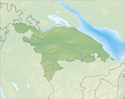
Affeltrangen is a municipality in the district of Münchwilen in the canton of Thurgau in Switzerland.
Affeltrangen is first mentioned in 779 as Affaltrawangas. In 1995 Affeltrangen merged with Buch bei Märwil, Märwil and Zezikon.
In the 8th and 9th Centuries, the Abbey of St. Gall acquired property in Affeltragen. In 1228 the Commandry of Tobel acquired the entire village, which was part of the court of Tobel from about 1280 until 1798.
Affeltrangen has an area, as of 2009[update], of 14.42 square kilometers (5.57 sq mi). Of this area, 10.58 km2 (4.08 sq mi) or 73.4% is used for agricultural purposes, while 2.25 km2 (0.87 sq mi) or 15.6% is forested. Of the rest of the land, 1.32 km2 (0.51 sq mi) or 9.2% is settled (buildings or roads), 0.08 km2 (20 acres) or 0.6% is either rivers or lakes and 0.13 km2 (32 acres) or 0.9% is unproductive land.
Of the built up area, industrial buildings made up 4.7% of the total area while housing and buildings made up 0.6% and transportation infrastructure made up 0.3%. while parks, green belts and sports fields made up 3.4%. Out of the forested land, 13.1% of the total land area is heavily forested and 2.5% is covered with orchards or small clusters of trees. Of the agricultural land, 65.4% is used for growing crops, while 8.0% is used for orchards or vine crops. All the water in the municipality is in lakes. Of the unproductive areas, and .
The municipality is located in the Münchwilen district, located in the upper Lauchetal (Lauch Valley). It consists of the villages of Affeltrangen, Buch bei Märwil, Märwil and Zezikon. Affeltragen consists of the hamlets of Affeltragen, Bollsteg, Isenegg, Kreuzegg, Nägelishub and Rüti.
Affeltrangen has a population (as of December 2015[update]) of 2,495 As of 2008[update], 11.8% of the population are foreign nationals. Over the last 10 years (1997–2007) the population has changed at a rate of 12%. Most of the population (as of 2000[update]) speaks German(91.8%), with Italian being second most common ( 2.5%) and Albanian being third ( 1.9%).
...
Wikipedia


