Alto Trás-os-Montes Subregion
| Alto Trás-os-Montes | |
| NUTS III Subregion (Subregião) | |
|
The olive trees in the municipality of Bragança
|
|
| Name origin: alto trás-os-montes, Portuguese for high behind-the-mountains | |
| Country | Portugal |
|---|---|
| Region | Norte |
| Border subregions | Ave, Cávado, Douro, Tâmega |
| Municipalities | Alfândega da Fé, Boticas, Bragança, Chaves, Macedo de Cavaleiros, Miranda do Douro, Mirandela, Mogadouro, Montalegre, Murça, Valpaços, Vila Pouca de Aguiar, Vimioso, Vinhais |
| Length | 161.17 km (100 mi), West-East |
| Width | 88.71 km (55 mi), North-South |
| Area | 8,171.62 km2 (3,155 sq mi) |
| Population | 214,460 (2008) Estimates |
| Density | 26.24/km2 (68/sq mi) |
| Timezone | WET (UTC0) |
| - summer (DST) | WEST (UTC+1) |
| ISO 3166-2 code | PT-04+17 |
| Area code | +351 |
| ccTLD | .pt |
| Demonym | Transmontanan |
| Currency | Euro (€) |
| Date format | dd-mm-yyyy |
| Drive | right-side |
|
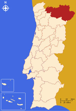
Location of the Alto Trás-os-Montes subregion in continental Portugal
|
|
| Statistics from INE (2001); geographic detail from Instituto Geográfico Português (2010) | |
Alto Trás-os-Montes (Portuguese pronunciation: [ˈaɫtu ˌtɾazuʒˈmõtɨʃ]), or Nordeste Transmontano, is a large NUTS-level 3 subregion of the Norte Region of Portugal. Its 15 municipalities occupy an area of 8,168 km2 (3,154 sq mi) in the north-east of continental Portugal with an estimated 2008 population of 214,460 inhabitants; thus it constitutes approximately 40% of the area, but only 6.1% of the population, of the Norte Region.
The Trás-os-Montes area refers to a contiguous territory that has similar social and cultural identities, but diverges on the potential economic abilities, while constituting a territorial unit with scale and critical mass to act in concert politically. In addition to its land border with Spain (in the north and north-northeast), it is also juxtapositioned with the subregions of the Douro (to the south), Tâmega Subregion (in the southwest), Ave (in the southwest) and Cávado (in the west). The NUTS III region of Alto Trás-os-Montes includes the following municipalities:
The inhabitants are not homogeneously distributed within the region: with most of the population concentrated in the principal urban agglomerations, the region has experienced a continuous process of rural-to-urban population migration to centres within or outside the region. Yet, simultaneously, the medium-to-small centres have taken on a catalytic role in urbanization and economic development.
The structure of the Trás-os-Montes hierarchy is highlighted by the largest of these "medium"-sized cities (Bragança, Mirandela and Chaves), corresponding to the principal urban poles, and articulated by a complementary urban network, constituted by the seats of the municipalities of Alfândega da Fé, Boticas, Macedo de Cavaleiros, Miranda do Douro, Mogadouro, Montalegre, Ribeira de Pena, Valpaços, Vila Flor, Vila Pouca de Aguiar, Vimioso and Vinhais.
The proximity of Trás-os-Montes with Spain has allowed a cross-cultural and cross-social partnership, that has helped to develop both social and economic projects.
...
Wikipedia


