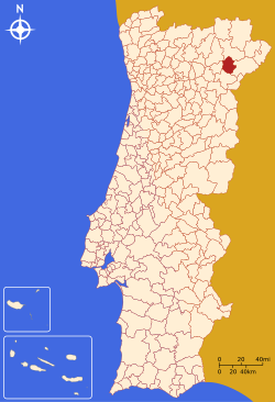
Alfândega da Fé Municipality
| Alfândega da Fé | |||
|---|---|---|---|
| Municipality | |||
|
|||
 |
|||
| Coordinates: 41°21′20″N 6°56′42″W / 41.35556°N 6.94500°WCoordinates: 41°21′20″N 6°56′42″W / 41.35556°N 6.94500°W | |||
| Country |
|
||
| Region | Norte | ||
| Subregion | Alto Trás-os-Montes | ||
| Intermunic. comm. | Terras de Trás-os-Montes | ||
| District | Bragança | ||
| Parishes | 12 | ||
| Government | |||
| • President | Berta Ferreira Milheiro Nunes (PS) | ||
| Elevation | 555 m (1,821 ft) | ||
| Population (2011) | |||
| • Total | 5,104 | ||
| Time zone | WET/WEST (UTC+0/+1) | ||
| Postal code | 5350 | ||
| Patron | São Pedro | ||
| Website | http://www.cm-alfandegadafe.pt | ||
Alfândega da Fé (Portuguese pronunciation: [aɫˈfɐ̃dɨɣɐ ðɐ ˈfɛ]) is a municipality in northeast Portugal. The population in 2011 was 5,104, in an area of 321.95 km².
Early archaeological sites, such as Castro hill fort settlements, can be found scattered throughout the municipality.
The municipality has an origin that comes from mixed Moorish influences and Christian faith. Alfandagh, the Arabic term for this region, which means hospice, castle or frontier, or literally "a place of calm hospitality populated by peaceful or hard-working peoples". In a published work of João Manuel d’Almeida Moraes Pessanha:
There are historical convictions that Alfândega, during Moorish occupation, was an administrative seat of some importance to a region referred to as Valiato de Aldandica. The conquest by Asturian Christians was to have likely resulted in the expulsion of the Moors, and the extension of its name with Fé (English: faith).
Some suggest that the settlement was the seat of an ancient order that pre-dated the Templars, that was referred to as the Ordem dos Cavaleiros das Esporas Douradas (Portuguese: Order of the Knights of the Golden Spurs). Legend suggests that these Templar Knights were responsible for liberating the lands, known as the Tributo das Donzelas.
The first foral was attributed on 8 May 1294, by King Dinis of Portugal, in a document that first defined the geographic limits of the municipality. On 17 September 1295, the monarch conceded a market charter, similar to one established for Covilhã (a new market charter was later passed by King John of Portugal on 13 January 1410). King Dinis then ordered the re-construction of the Moorish castle (yet, over time, the structure fell into ruins and its remains eventually disappeared). A 1530 census found the structure in ruins. The town's landmarks are considered the remains of the Moorish influences in the town, for example the clock tower Torre do Relógio. Tombo dos Bens do Concelho (1766) makes references to Moorish influences.
...
Wikipedia


