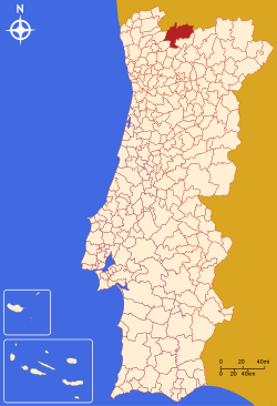
Montalegre Municipality
| Montalegre | |||
|---|---|---|---|
| Municipality | |||

The hilltop Montalegre Castle
|
|||
|
|||
 |
|||
| Coordinates: 41°49′23″N 7°47′30″W / 41.82306°N 7.79167°WCoordinates: 41°49′23″N 7°47′30″W / 41.82306°N 7.79167°W | |||
| Country |
|
||
| Region | Norte | ||
| Subregion | Alto Trás-os-Montes | ||
| Intermunic. comm. | Alto Tâmega | ||
| District | Vila Real | ||
| Parishes | 27 (see text) | ||
| Government | |||
| • President | Fernando José Gomes Rodrigues (PS) | ||
| Area | |||
| • Total | 805.46 km2 (310.99 sq mi) | ||
| Elevation | 884 m (2,900 ft) | ||
| Population (2011) | |||
| • Total | 10,537 | ||
| • Density | 13/km2 (34/sq mi) | ||
| Time zone | WET/WEST (UTC+0/+1) | ||
| Postal code | 5470 | ||
| Area code | 276 | ||
| Patron | Nossa Senhora da Piedade | ||
| Website | http://www.cm-montalegre.pt | ||
Montalegre (Portuguese pronunciation: [mõtɐˈlɛɣɾ(ɨ)]) is a municipality in northern Portugal, located in the district of Vila Real, along the border with Spain. The population in 2011 was 10,537, in an area of 805.46 km².
Early construction in Montalegre date back 3500–4000 years when early inhabitants, around the villages of Mourela, Veiga and Vila da Ponte, buried their dead in funeral mounds. Vestiges of this culture predominate the region, and suggest that settlements have been ongoing since the Metal Ages.
Celt colonies began to appear afterward, constructing castros in many of the places that developed into formal settlements. With the arrival of the Roman, bridges and formal roads began to appear, while many of the castros began to be converted into Roman encampments, later the nuclei of formalized settlements. Remains of the Roman civitas are still common: Praesidium (in Vila da Ponte, popularly known as Sabaraz) and Caladunum (in Cervos).
Although there were no overt indications that the Moors settled in this region, although oral tradition inferred as much.
With the establishment of the Christian kingdom of Portugal, Afonso Henriques donated portions of the land for charitable hospices (Salto), hospitals (Vilar de Perdizes and Dornelas) or monasteries (Pitões). Owing to its location, on the border with Galiza, defense fortifications were constructed, including the Castles of Gerês and Piconha, and later in Portelo and the village of Montalegre. A lighthouse was also constructed in Tourém, likely by King Sancho in 1187, since he was the master of the Terras da Piconha region.
It was only in September 1273 that King Afonso III bestowed on the citizens a foral (charter), founding the town of Montalegre and making the local sheriff the master of the Terras de Barroso. The foral was later confirmed by King Denis in 1289, and renewed by Afonso IV (in 1340), John II (in 1491), and Manuel (in 1515).
...
Wikipedia


