2013–14 South-West Indian Ocean cyclone season
| 2013–14 South-West Indian Ocean cyclone season |

Season summary map
|
| Seasonal boundaries |
| First system formed |
October 23, 2013 |
| Last system dissipated |
April 6, 2014 |
| Strongest storm |
|
| Name |
Hellen |
| • Maximum winds |
230 km/h (145 mph)
(10-minute sustained) |
| • Lowest pressure |
915 hPa (mbar) |
| Seasonal statistics |
| Total disturbances |
15 |
| Total depressions |
13 |
| Total storms |
11 |
| Tropical cyclones |
5 |
| Intense tropical cyclones |
5 |
| Very intense tropical cyclones |
2 |
| Total fatalities |
11 total |
| Total damage |
At least $89.2 million (2014 USD) |
| Related articles |
|
|
South-West Indian Ocean tropical cyclone seasons
2011–12, 2012–13, 2013–14, 2014–15, 2015–16
|
| Moderate tropical storm (MFR) |
| Tropical storm (SSHWS) |
|
|
| Duration |
October 23 – October 27 |
| Peak intensity |
65 km/h (40 mph) (10-min) 997 hPa (mbar) |
| Intense tropical cyclone (MFR) |
| Category 4 tropical cyclone (SSHWS) |
|
|
| Duration |
December 14 – December 27 |
| Peak intensity |
205 km/h (125 mph) (10-min) 935 hPa (mbar) |
| Very intense tropical cyclone (MFR) |
| Category 5 tropical cyclone (SSHWS) |
|
|
| Duration |
December 20 (Entered basin) – December 23 |
| Peak intensity |
220 km/h (140 mph) (10-min) 920 hPa (mbar) |
| Intense tropical cyclone (MFR) |
| Category 4 tropical cyclone (SSHWS) |
|
|
| Duration |
December 27 – January 4 |
| Peak intensity |
175 km/h (110 mph) (10-min) 950 hPa (mbar) |
| Tropical depression (MFR) |
|
|
| Duration |
January 7 – January 10 |
| Peak intensity |
55 km/h (35 mph) (10-min) 997 hPa (mbar) |
| Intense tropical cyclone (MFR) |
| Category 4 tropical cyclone (SSHWS) |
|
|
| Duration |
January 9 (Entered basin) – January 14 |
| Peak intensity |
205 km/h (125 mph) (10-min) 915 hPa (mbar) |
| Moderate tropical storm (MFR) |
| Tropical storm (SSHWS) |
|
|
| Duration |
January 14 – January 22 |
| Peak intensity |
85 km/h (50 mph) (10-min) 990 hPa (mbar) |
| Zone of Disturbed Weather (MFR) |
|
|
| Duration |
January 16 – January 20 |
| Peak intensity |
35 km/h (25 mph) (10-min) 1004 hPa (mbar) |
| Tropical disturbance (MFR) |
|
|
| Duration |
January 24 – January 31 |
| Peak intensity |
45 km/h (30 mph) (10-min) 1002 hPa (mbar) |
The 2013–14 South-West Indian Ocean cyclone season is an event in the annual cycle of tropical cyclone formation that ended on June 30, 2014. The season officially began on July 1, 2013, though the first tropical system designated by Météo-France was a short-lived tropical disturbance that developed on July 8. However, the first named storm was Cyclone Amara in December. Bruce was the first very intense tropical cyclone since Edzani in 2010, which originated from the Australian region. The strongest system of the cyclone season was Hellen, also one of the most intense tropical cyclones over the Mozambique Channel.
Within this basin, tropical and subtropical disturbances are officially monitored by the Regional Specialised Meteorological Centre on Réunion island, while the Mauritius and Madagascar weather services assign names to significant tropical and subtropical disturbances.
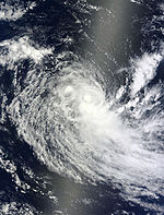
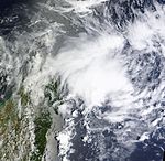
The predecessor to the season's first designated tropical depression began as an area of persistent convection well removed from any landmasses. The JTWC began issuing products on the storm complex on October 21, noting recent consolidation patterns and its association with an ill-defined low-level circulation center. Over subsequent hours, the system developed a central region of convection with incipient rainbands. Despite these signs of potential tropical cyclogenesis in the very near future, the storm remained unclassified for several days as it tracked generally towards the west. At 1200 UTC on October 25, however, Météo-France classified the system as a tropical disturbance. Though upper-level atmospheric conditions were rather conducive for continued strengthening, factors including decreasing convergence and marginally sustainable sea surface temperatures were expected to inhibit tropical development, and as such initial forecasts only anticipated minimal and gradual strengthening.
...
Wikipedia


