2013–14 South Pacific cyclone season
| 2013–14 South Pacific cyclone season |
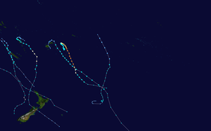
Season summary map
|
| Seasonal boundaries |
| First system formed |
October 19, 2013 |
| Last system dissipated |
March 20, 2014 |
| Strongest storm |
|
| Name |
Ian |
| • Maximum winds |
205 km/h (125 mph)
(10-minute sustained) |
| • Lowest pressure |
930 hPa (mbar) |
| Seasonal statistics |
| Total disturbances |
20 |
| Total depressions |
13 |
| Tropical cyclones |
6 |
| Severe tropical cyclones |
2 |
| Total fatalities |
12 total |
| Total damage |
$48 million (2014 USD) |
| Related articles |
|
|
South Pacific tropical cyclone seasons
2011–12, 2012–13, 2013–14, 2014–15, 2015–16
|
| Tropical depression (Australian scale) |
|
|
| Duration |
October 19 – October 23 |
| Peak intensity |
Winds not specified 1002 hPa (mbar) |
| Category 5 severe tropical cyclone (Australian scale) |
| Category 4 tropical cyclone (SSHWS) |
|
|
| Duration |
January 2 – January 14 |
| Peak intensity |
205 km/h (125 mph) (10-min) 935 hPa (mbar) |
| Category 1 tropical cyclone (Australian scale) |
| Tropical storm (SSHWS) |
|
|
| Duration |
January 13 – January 19 |
| Peak intensity |
75 km/h (45 mph) (10-min) 990 hPa (mbar) |
| Category 2 tropical cyclone (Australian scale) |
| Tropical storm (SSHWS) |
|
|
| Duration |
February 4 (Entered basin) – February 6 |
| Peak intensity |
95 km/h (60 mph) (10-min) 985 hPa (mbar) |
| Category 2 tropical cyclone (Australian scale) |
| Tropical storm (SSHWS) |
|
|
| Duration |
February 24 – March 4 |
| Peak intensity |
100 km/h (65 mph) (10-min) 980 hPa (mbar) |
| Category 3 severe tropical cyclone (Australian scale) |
| Category 1 tropical cyclone (SSHWS) |
|
|
| Duration |
March 7 – March 14 |
| Peak intensity |
150 km/h (90 mph) (10-min) 960 hPa (mbar) |
| Category 1 tropical cyclone (Australian scale) |
| Tropical storm (SSHWS) |
|
|
| Duration |
March 12 – March 20 |
| Peak intensity |
65 km/h (40 mph) (10-min) 990 hPa (mbar) |
The 2013–14 South Pacific cyclone season was a near normal tropical cyclone season, with six tropical cyclones occurring within the basin between 160°E and 120°W. The season ran from November 1, 2013 to April 30, 2014, however, the first four tropical disturbances occurred during October 2013 and were included as a part of the season. During the season, tropical cyclones were officially monitored by the Fiji Meteorological Service (FMS), Australian Bureau of Meteorology (BoM) and New Zealand's MetService. The United States Joint Typhoon Warning Center (JTWC) and other national meteorological services including Météo-France and NOAA also monitored the basin during the season. During the season there were 21 significant tropical disturbances were assigned a number and an "F" suffix by the FMS's Regional Specialized Meteorological Center in Nadi, Fiji (RSMC Nadi), including the remnants of Tropical Cyclone Hadi from the Australian region. The BoM, MetService and RSMC Nadi all estimated sustained wind speeds over a period of 10-minutes and used the Australian tropical cyclone intensity scale, while the JTWC estimated sustained winds over a 1-minute period, which are subsequently compared to the Saffir–Simpson hurricane wind scale (SSHS).
Ahead of the cyclone season, the BoM, the FMS, MetService, the New Zealand National Institute of Water and Atmospheric Research (NIWA) and various other Pacific Meteorological services, all contributed towards the Island Climate Update tropical cyclone outlook that was released during October 2013. The outlook took into account the ENSO neutral conditions that had been observed across the Pacific and analogue seasons that had ENSO neutral conditions occurring during the season. The outlook called for a near average number of tropical cyclones for the 2013–14 season, with eight to twelve named tropical cyclones, to occur between 135°E and 120°W compared to an average of 10. At least four of the tropical cyclones were expected to become category 3 severe tropical cyclones, while three could become category 4 severe tropical cyclones, they also noted that a Category 5 severe tropical cyclone was unlikely to occur. In addition to contributing towards the Island Climate Update outlook, the FMS and the BoM both issued their own seasonal forecasts for the South Pacific region.
...
Wikipedia


