2011 Pacific typhoon season
| 2011 Pacific typhoon season |

Season summary map
|
| Seasonal boundaries |
| First system formed |
April 1, 2011 |
| Last system dissipated |
January 1, 2012 |
| Strongest storm |
|
| Name |
Songda |
| • Maximum winds |
195 km/h (120 mph)
(10-minute sustained) |
| • Lowest pressure |
920 hPa (mbar) |
| Seasonal statistics |
| Total depressions |
39 |
| Total storms |
21 |
| Typhoons |
8 |
| Super typhoons |
4 (Unofficial)
|
| Total fatalities |
1823 total |
| Total damage |
$10.6 billion (2011 USD) |
| Related articles |
|
|
Pacific typhoon seasons
2009, 2010, 2011, 2012, 2013
|
| Tropical depression (JMA) |
| Tropical depression (SSHWS) |
|
|
| Duration |
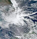
April 1 – April 4 |
| Peak intensity |
55 km/h (35 mph) (10-min) 1004 hPa (mbar) |
| Tropical depression (JMA) |
| Tropical depression (SSHWS) |
|
|
| Duration |
April 3 – April 6 |
| Peak intensity |
55 km/h (35 mph) (10-min) 1000 hPa (mbar) |
| Tropical storm (JMA) |
| Tropical storm (SSHWS) |
|
|
| Duration |
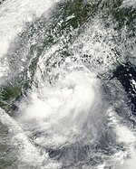
May 6 – May 12 |
| Peak intensity |
75 km/h (45 mph) (10-min) 992 hPa (mbar) |
| Typhoon (JMA) |
| Category 5 super typhoon (SSHWS) |
|
|
| Duration |
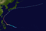
May 19 – May 29 |
| Peak intensity |
195 km/h (120 mph) (10-min) 920 hPa (mbar) |
| Tropical storm (JMA) |
| Tropical depression (SSHWS) |
|
|
| Duration |
June 8 – June 11 |
| Peak intensity |
75 km/h (45 mph) (10-min) 996 hPa (mbar) |
| Tropical storm (JMA) |
| Tropical storm (SSHWS) |
|
|
| Duration |
June 16 – June 25 |
| Peak intensity |
75 km/h (45 mph) (10-min) 985 hPa (mbar) |
| Severe tropical storm (JMA) |
| Tropical storm (SSHWS) |
|
|
| Duration |
June 20 – June 27 |
| Peak intensity |
110 km/h (70 mph) (10-min) 975 hPa (mbar) |
| Tropical depression (JMA) |
|
|
| Duration |
July 8 – July 10 |
| Peak intensity |
45 km/h (30 mph) (10-min) 998 hPa (mbar) |
| Typhoon (JMA) |
| Category 4 typhoon (SSHWS) |
|
|
| Duration |
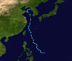
July 11 – July 24 |
| Peak intensity |
175 km/h (110 mph) (10-min) 935 hPa (mbar) |
The 2011 Pacific typhoon season was a below average season that produced a total of 21 named storms, 8 typhoons and four super typhoons. This season was much active than the previous season, although both seasons were way below the Pacific typhoon average of 27. The season ran throughout 2011, though most tropical cyclone tend to develop between May and October. The season’s first named storm, Aere, developed on May 7 while the season’s last named storm, Washi dissipated on December 19. The season was also much deadly and destructive than the previous season. Typhoon Muifa affected many countries during August. Tropical Storm Talas and Typhoon Roke made landfall over in Japan and were the most destructive since 2009. Typhoon Nesat was the most powerful to strike China since 2005. Tropical Storm Washi, a late but weak cyclone, affected southern Philippines and killed more than 1,200 people.
The scope of this article is limited to the Pacific Ocean to the north of the equator between 100th meridian east and the 180th meridian. Within the Northwestern Pacific Ocean, there are two separate agencies who assign names to tropical cyclones which can often result in a cyclone having two names. The Japan Meteorological Agency will name a tropical cyclone should it be judged to have 10-minute sustained wind speeds of at least 65 km/h, (40 mph) anywhere in the basin. Whilst the Philippine Atmospheric, Geophysical and Astronomical Services Administration assigns names to tropical cyclones which move into or form as a tropical depression in their area of responsibility located between 135°E and 115°E and between 5°N-25°N even if the cyclone has had a name assigned to it by the Japan Meteorological Agency. Tropical depressions that are monitored by the United States' Joint Typhoon Warning Center are given a number with a "W" suffix.
...
Wikipedia


