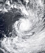
2004–05 South Pacific cyclone season
| 2004–05 South Pacific cyclone season |

Season summary map
|
| Seasonal boundaries |
| First system formed |
October 28, 2004 |
| Last system dissipated |
May 1, 2005 |
| Strongest storm |
|
| Name |
Percy |
| • Maximum winds |
230 km/h (145 mph)
(10-minute sustained) |
| • Lowest pressure |
900 hPa (mbar) |
| Seasonal statistics |
| Total disturbances |
18 |
| Total depressions |
17 |
| Tropical cyclones |
9 |
| Severe tropical cyclones |
5 |
| Total fatalities |
Unknown |
| Total damage |
$55 million (2005 USD) |
| Related articles |
|
|
South Pacific tropical cyclone seasons
2002–03, 2003–04, 2004–05, 2005–06, 2006–07
|
| Category 1 tropical cyclone (Australian scale) |
|
|
| Duration |
December 21 – December 27 |
| Peak intensity |
85 km/h (50 mph) (10-min) 989 hPa (mbar) |
| Category 3 severe tropical cyclone (Australian scale) |
| Category 2 tropical cyclone (SSHWS) |
|
|
| Duration |
January 5 – January 14 |
| Peak intensity |
140 km/h (85 mph) (10-min) 970 hPa (mbar) |
| Category 1 tropical cyclone (Australian scale) |
|
|
| Duration |
January 26 – February 2 |
| Peak intensity |
75 km/h (45 mph) (10-min) 990 hPa (mbar) |
| Category 5 severe tropical cyclone (Australian scale) |
| Category 4 tropical cyclone (SSHWS) |
|
|
| Duration |
February 1 – February 8 |
| Peak intensity |
215 km/h (130 mph) (10-min) 915 hPa (mbar) |
| Category 5 severe tropical cyclone (Australian scale) |
| Category 5 tropical cyclone (SSHWS) |
|
|
| Duration |
February 10 – February 20 |
| Peak intensity |
215 km/h (130 mph) (10-min) 915 hPa (mbar) |
| Category 4 severe tropical cyclone (Australian scale) |
| Category 4 tropical cyclone (SSHWS) |
|
|
| Duration |
February 10 – February 17 |
| Peak intensity |
175 km/h (110 mph) (10-min) 935 hPa (mbar) |
| Category 5 severe tropical cyclone (Australian scale) |
| Category 5 tropical cyclone (SSHWS) |
|
|
| Duration |
February 24 – March 5 |
| Peak intensity |
230 km/h (145 mph) (10-min) 900 hPa (mbar) |
| Category 1 tropical cyclone (Australian scale) |
| Tropical storm (SSHWS) |
|
|
| Duration |
February 28 – March 6 |
| Peak intensity |
75 km/h (45 mph) (10-min) 990 hPa (mbar) |
| Tropical depression (Australian scale) |
|
|
| Duration |
March 2 – March 4 |
| Peak intensity |
Winds not specified 1001 hPa (mbar) |
The 2004–05 South Pacific cyclone season was a near-average tropical cyclone season, that contained nineteen tropical disturbances and nine tropical cyclones. The season got off to an early start, when Tropical Depression 01F developed near the Solomon Islands on October 28, three days before the official start of the season on November 1. The final disturbance of the season dissipated as the season was drawing to a close on May 1, 2005. Tropical cyclones between 160°E and 120°W and north of 25°S are monitored by the Fiji Meteorological Service in Nadi. Those that move south of 25°S are monitored by the Tropical Cyclone Warning Centre in Wellington, New Zealand.
The first tropical depression of the season developed on October 28 to the northeast of Guadalcanal in the Solomon Islands. Over the next few days the system moved westwards and moved into the Australian region during October 30. There were no significant tropical disturbances observed during November, before Tropical Depression 02F developed to the north of Vanuatu during December 3. The system subsequently meandered over the ocean between Vanuatu and Fiji, before it was last noted to the southeast of Vanuatu during December 14. While Tropical Depression 02F was active, the third tropical depression of the season, developed to the south of Tuvalu on December 5. The system subsequently moved south-eastwards, before it was last noted during December 10 to the east of Nuku'alofa, Tonga. The fourth tropical disturbance of the season developed during December 21 and subsequently moved south-westwards, before it was named Judy during December 24, as it developed into the first tropical cyclone of the season.
On December 21, RSMC Nadi reported that Tropical Disturbance 04F had developed, along an active and slow-moving monsoon trough near French Polynesia. The depression was in an area of high shear, with the deep convection located to the northeast of the center. The low level circulation center at this time was exposed but was developing despite the high shear associated with the system. Early on December 24 deep convection associated with the system moved over the low level circulation center whilst the system was getting better organized. Later that day at 1800 UTC the Depression was upgraded to a category one tropical cyclone and was named Judy whilst located about 510 km (320 mi) southeast of Tahiti and moving towards the southwest. During the next few hours under strengthening shear, Judy struggled to maintain itself. However, as it moved further to the south if came under a strengthening steering field which was being enhanced by a trough of low pressure to the west of the steering field which helped to neutralize the effect of the shear over the cyclone. Judy then intensified slightly further and reached its peak intensity of 85 km/h, (50 mph), with a peak pressure of 989 hPa late on December 25 whilst turning towards the south towards TCWC Wellington's area of responsibility. Judy degenerated into an extratropical cyclone during December 27, before it was last noted later that day as it merged with an area of low pressure to the south of Tahiti.
...
Wikipedia


