1991–92 South-West Indian Ocean cyclone season
| 1991–92 South-West Indian Ocean cyclone season |

Season summary map
|
| Seasonal boundaries |
| First system formed |
September 11, 1991 |
| Last system dissipated |
April 19, 1992 |
| Strongest storm |
|
| Name |
Harriet-Heather |
| • Maximum winds |
165 km/h (105 mph)
(10-minute sustained) |
| • Lowest pressure |
930 hPa (mbar) |
| Seasonal statistics |
| Total depressions |
14 |
| Total storms |
10, 1 unofficial |
| Tropical cyclones |
3 |
| Intense tropical cyclones |
1 |
| Total fatalities |
2 |
| Total damage |
Unknown |
| Related articles |
|
|
South-West Indian Ocean tropical cyclone seasons
1989–90, 1990–91, 1991–92, 1992–93, 1993–94
|
| Severe tropical storm (MFR) |
| Category 3 tropical cyclone (SSHWS) |
|
|
| Duration |
December 18 – December 29 |
| Peak intensity |
105 km/h (65 mph) (10-min) 972 hPa (mbar) |
| Moderate tropical storm (MFR) |
| Tropical storm (SSHWS) |
|
|
| Duration |
December 25 – January 10 |
| Peak intensity |
70 km/h (45 mph) (10-min) 988 hPa (mbar) |
| Moderate tropical storm (MFR) |
| Tropical storm (SSHWS) |
|
|
| Duration |
February 8 – February 14 |
| Peak intensity |
80 km/h (50 mph) (10-min) 985 hPa (mbar) |
| Moderate tropical storm (MFR) |
| Tropical storm (SSHWS) |
|
|
| Duration |
February 16 – February 25 |
| Peak intensity |
70 km/h (45 mph) (10-min) 988 hPa (mbar) |
| Moderate tropical storm (MFR) |
| Tropical storm (SSHWS) |
|
|
| Duration |
February 22 – February 26 |
| Peak intensity |
65 km/h (40 mph) (10-min) 992 hPa (mbar) |
| Tropical cyclone (MFR) |
| Category 4 tropical cyclone (SSHWS) |
|
|
| Duration |
February 23 – March 4 |
| Peak intensity |
150 km/h (95 mph) (10-min) 941 hPa (mbar) |
| Moderate tropical storm (MFR) |
| Tropical storm (SSHWS) |
|
|
| Duration |
February 24 – March 4 |
| Peak intensity |
65 km/h (40 mph) (10-min) 992 hPa (mbar) |
| Intense tropical cyclone (MFR) |
| Category 4 tropical cyclone (SSHWS) |
|
|
| Duration |
March 1 (Entered basin) – March 7 (Out of area)
|
| Peak intensity |
165 km/h (105 mph) (10-min) 930 hPa (mbar) |
| Tropical cyclone (MFR) |
| Category 4 tropical cyclone (SSHWS) |
|
|
| Duration |
April 14 (Entered basin) – April 19 (Exited basin)
|
| Peak intensity |
140 km/h (85 mph) (10-min) 950 hPa (mbar) |
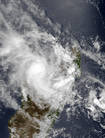
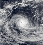
The 1991–92 South-West Indian Ocean cyclone season was an average cyclone season in which most storms remained over open waters. At the time, the season lasted from November 15, 1991, to April 30, 1992, although this season began early when three tropical depressions formed before the official start. The second, designated Tropical Depression A2 by the Météo-France office (MFR) on Réunion, passed north of Madagascar on October 16 before weakening. The first named storm was Severe Tropical Storm Alexandra, which developed on December 18 from the monsoon trough; many other storms during the year originated in this manner. Tropical Storm Bryna was the only tropical storm of the season to make landfall, having struck northeastern Madagascar on January 2. The basin was most active in February, when five named storms developed, including Tropical Depression Elizabetha which struck western Madagascar. In early March, Cyclone Harriet entered the basin from the Australian region and was renamed Heather. It intensified to peak winds of 165 km/h (105 mph), making Heather the strongest storm of the season. In April, another cyclone – Jane – crossed from the Australian region and was renamed Irna, which reentered the Australian region on April 19 to end tropical activity within the basin.
In general, sea surface temperatures were warmest near the equator in the northeast portion of the basin, and in the Mozambique Channel between Mozambique and Madagascar. During the season, the Météo-France office (MFR) on Réunion island issued warnings in tropical cyclones within the basin. The agency estimated intensity through the Dvorak technique, and warned on tropical cyclones in the region from the coast of Africa to 80° E, south of the equator. The Joint Typhoon Warning Center (JTWC), which is a joint United States Navy – United States Air Force task force, also issued tropical cyclone warnings for the southwestern Indian Ocean.
...
Wikipedia


