1989–90 South-West Indian Ocean cyclone season
| 1989–90 South-West Indian Ocean cyclone season |

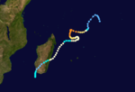
Season summary map
|
| Seasonal boundaries |
| First system formed |
December 14, 1989 |
| Last system dissipated |
May 21, 1990 |
| Strongest storm |
|
| Name |
Walter-Gregoara |
| • Maximum winds |
170 km/h (105 mph)
(10-minute sustained) |
| • Lowest pressure |
927 hPa (mbar) |
| Seasonal statistics |
| Total depressions |
9 (4 unofficial) |
| Total storms |
9 (2 unofficial) |
| Tropical cyclones |
4 |
| Total fatalities |
46 |
| Total damage |
$1.5 million (1990 USD) |
| Related articles |
|
|
South-West Indian Ocean tropical cyclone seasons
1987–88, 1988–89, 1989–90, 1990–91, 1991–92
|
| Tropical cyclone (MFR) |
| Category 4 tropical cyclone (SSHWS) |
|
|
| Duration |
December 16 – January 5 |
| Peak intensity |
140 km/h (85 mph) (10-min) 954 hPa (mbar) |
| Tropical cyclone (MFR) |
| Category 2 tropical cyclone (SSHWS) |
|
|
| Duration |
January 2 – January 9 |
| Peak intensity |
150 km/h (95 mph) (10-min) 941 hPa (mbar) |
| Severe tropical storm (MFR) |
| Category 1 tropical cyclone (SSHWS) |
|
|
| Duration |
January 31 – February 11 |
| Peak intensity |
95 km/h (60 mph) (10-min) 976 hPa (mbar) |
| Tropical cyclone (MFR) |
| Category 2 tropical cyclone (SSHWS) |
|
|
| Duration |
February 2 – February 11 |
| Peak intensity |
135 km/h (85 mph) (10-min) 954 hPa (mbar) |
| Tropical cyclone (MFR) |
| Category 3 tropical cyclone (SSHWS) |
|
|
| Duration |
March 1 – March 8 |
| Peak intensity |
135 km/h (85 mph) (10-min) 954 hPa (mbar) |
| Moderate tropical storm (MFR) |
| Tropical storm (SSHWS) |
|
|
| Duration |
March 7 – March 16 |
| Peak intensity |
65 km/h (40 mph) (10-min) 991 hPa (mbar) |
| Intense tropical cyclone (MFR) |
| Category 3 tropical cyclone (SSHWS) |
|
|
| Duration |
March 13 (entered basin) – March 27 |
| Peak intensity |
170 km/h (105 mph) (10-min) 927 hPa (mbar) |
| Moderate tropical storm (MFR) |
| Tropical storm (SSHWS) |
|
|
| Duration |
April 11 – April 14 |
| Peak intensity |
65 km/h (40 mph) (10-min) 991 hPa (mbar) |
| Severe tropical storm (MFR) |
| Tropical storm (SSHWS) |
|
|
| Duration |
May 11 – May 21 |
| Peak intensity |
95 km/h (60 mph) (10-min) 976 hPa (mbar) |
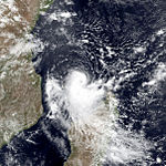
The 1989–90 South-West Indian Ocean cyclone season was an average cyclone season, with nine named storms and five tropical cyclones – a storm attaining maximum sustained winds of at least 120 km/h (75 mph). The season officially ran from November 1, 1989, to April 30, 1990. Storms were officially tracked by the Météo-France office (MFR) on Réunion while the Joint Typhoon Warning Center (JTWC) in an unofficial basis. The first storm, Cyclone Alibera, was the second longest-lasting tropical cyclone on record in the basin, with a duration of 22 days. Alibera meandered and changed directions several times before striking southeastern Madagascar on January 1, 1989, where it was considered the worst storm since 1925. The cyclone killed 46 people and left widespread damage. Only the final storm of the year – Severe Tropical Storm Ikonjo – also had significant impact on land, when it left $1.5 million in damage (1990 USD) in the Seychelles.
Of the remaining storms, several passed near the Mascarene Islands but did not cause much impact. In early February, Severe Tropical Storm Cezera and Tropical Cyclone Dety were active at the same time and interacted with each other through the process of the Fujiwhara effect. Cyclone Gregoara was the strongest of the season, which originated as Cyclone Walter from the adjacent Australian basin. Gregoara attained peak winds of 170 km/h (110 mph) over the open waters of the Indian Ocean in March, although the JTWC considered Alibera to be stronger. In April, Moderate Tropical Storm Hanta approached the northwest coast of Madagascar, but dissipated over the Mozambique Channel.
During the season, the Météo-France office (MFR) on Réunion island issued warnings in tropical cyclones within the basin. Using satellite imagery from National Oceanic and Atmospheric Administration, the agency estimated intensity through the Dvorak technique, and warned on tropical cyclones in the region from the coast of Africa to 90° E, south of the equator. The Joint Typhoon Warning Center (JTWC), which is a joint United States Navy – United States Air Force task force, also issued tropical cyclone warnings for the southwestern Indian Ocean. The season's nine named storms and five tropical cyclones – a storm attaining maximum sustained winds of at least 120 km/h (75 mph) – is the same as the long term average for the basin.
...
Wikipedia


