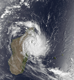
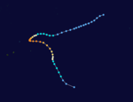
1987–88 South-West Indian Ocean cyclone season
| 1987–88 South-West Indian Ocean cyclone season |

Season summary map
|
| Seasonal boundaries |
| First system formed |
December 9, 1988 |
| Last system dissipated |
May 14, 1988 |
| Strongest storm |
|
| Name |
Gasitao |
| • Maximum winds |
170 km/h (105 mph)
(10-minute sustained) |
| • Lowest pressure |
927 hPa (mbar) |
| Seasonal statistics |
| Total storms |
9 (2 unofficial) |
| Tropical cyclones |
4 |
| Total fatalities |
100 |
| Total damage |
$10 million (1988 USD) |
| Related articles |
|
|
South-West Indian Ocean tropical cyclone seasons
1985–86, 1986–87, 1987–88, 1988–89, 1989–90
|
| Severe tropical storm (MFR) |
| Tropical storm (SSHWS) |
|
|
| Duration |
December 9 (Entered basin) – December 16 |
| Peak intensity |
115 km/h (70 mph) (10-min) 966 hPa (mbar) |
| Moderate tropical storm (MFR) |
| Tropical storm (SSHWS) |
|
|
| Duration |
December 25 – January 4 |
| Peak intensity |
65 km/h (40 mph) (10-min) 991 hPa (mbar) |
| Severe tropical storm (MFR) |
| Category 1 tropical cyclone (SSHWS) |
|
|
| Duration |
January 11 – January 21 |
| Peak intensity |
115 km/h (70 mph) (10-min) 966 hPa (mbar) |
| Tropical cyclone (MFR) |
| Category 4 tropical cyclone (SSHWS) |
|
|
| Duration |
January 22 – February 1 |
| Peak intensity |
135 km/h (85 mph) (10-min) 954 hPa (mbar) |
| Tropical cyclone (MFR) |
| Category 2 tropical cyclone (SSHWS) |
|
|
| Duration |
February 12 (Entered basin) – February 18 |
| Peak intensity |
150 km/h (95 mph) (10-min) 941 hPa (mbar) |
| Tropical cyclone (MFR) |
| Category 2 tropical cyclone (SSHWS) |
|
|
| Duration |
February 23 – March 2 |
| Peak intensity |
135 km/h (85 mph) (10-min) 954 hPa (mbar) |
| Intense tropical cyclone (MFR) |
| Category 4 tropical cyclone (SSHWS) |
|
|
| Duration |
March 15 – March 25 |
| Peak intensity |
170 km/h (105 mph) (10-min) 927 hPa (mbar) |
| Severe tropical storm (MFR) |
| Tropical storm (SSHWS) |
|
|
| Duration |
March 16 – April 2 |
| Peak intensity |
95 km/h (60 mph) (10-min) 976 hPa (mbar) |
| Moderate tropical storm (MFR) |
| Tropical storm (SSHWS) |
|
|
| Duration |
May 6 – May 14 |
| Peak intensity |
65 km/h (40 mph) (10-min) 991 hPa (mbar) |
The 1987–88 South-West Indian Ocean cyclone season was a moderately active cyclone season, with nine named storms. Four of the storms attained tropical cyclone status, which is the equivalent of a minimal hurricane with 10 minute sustained winds of at least 120 km/h (75 mph). The seasonal activity was evenly dispersed, officially beginning on December 9 when the Météo-France office (MFR) on Réunion started tracking Tropical Storm Ariny. The storm crossed 90° E from the adjacent Australian basin, one of two storms in the season to do so along with Cyclone Ezenina. There were also two storms tracked unofficially by the Joint Typhoon Warning Center (JTWC) in November.
Cyclone Filao was the most notable storm of the season, originating in late February off northern Madagascar. It ultimately struck Mozambique on March 1, where it killed about 100 people and left $10 million in damage (1988 USD). In January, both tropical storms Calidera and Doaza crossed Madagascar, the latter of which helped end a drought. Long-lasting Tropical Storm Hely also struck the country in March. The strongest cyclone of the season was Gasitao, which formed at the same time as Hely and attained peak winds of 150 km/h (95 mph). The season ended when Tropical Storm Iarisena dissipated northeast of Madagascar in the middle of May.
During the season, the Météo-France office (MFR) on Réunion island issued warnings in tropical cyclones within the basin. Using satellite imagery from National Oceanic and Atmospheric Administration, the agency estimated intensity through the Dvorak technique, and warned on tropical cyclones in the region from the coast of Africa to 90° E, south of the equator. The World Meteorological Organization recognized the MFR as a Regional Tropical Cyclone Advisory Centre in 1988, and would later label the agency as a Regional Specialized Meteorological Center in 1993. The Joint Typhoon Warning Center (JTWC), which is a joint United States Navy – United States Air Force task force, also issued tropical cyclone warnings for the southwestern Indian Ocean. The season's nine named storms is equal to the long term average, while the five tropical cyclones – a storm attaining maximum sustained winds of at least 120 km/h (75 mph) – was slightly below average. The MFR considered the tropical cyclone year to begin on August 1 and continue to July 31 of the following year.
...
Wikipedia


