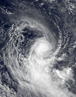
1988–89 South-West Indian Ocean cyclone season
| 1988–89 South-West Indian Ocean cyclone season |

Season summary map
|
| Seasonal boundaries |
| First system formed |
November 1, 1988 |
| Last system dissipated |
April 11, 1989 |
| Strongest storm |
|
| Name |
Hanitra and Krisy |
| • Maximum winds |
150 km/h (95 mph)
(10-minute sustained) |
| • Lowest pressure |
940 hPa (mbar) |
| Seasonal statistics |
| Total depressions |
12 (1 unofficial) |
| Total storms |
11 (1 unofficial) |
| Tropical cyclones |
5 |
| Total fatalities |
11 |
| Total damage |
$217 million (1989 USD) |
| Related articles |
|
|
South-West Indian Ocean tropical cyclone seasons
1986–87, 1987–88, 1988–89, 1989–90, 1990–91
|
| Moderate tropical storm (MFR) |
| Category 1 tropical cyclone (SSHWS) |
|
|
| Duration |
November 1 – November 8 |
| Peak intensity |
65 km/h (40 mph) (10-min) 991 hPa (mbar) |
| Tropical cyclone (MFR) |
| Category 3 tropical cyclone (SSHWS) |
|
|
| Duration |
November 12 (Entered basin) – November 23 |
| Peak intensity |
135 km/h (85 mph) (10-min) 954 hPa (mbar) |
| Tropical cyclone (MFR) |
| Category 1 tropical cyclone (SSHWS) |
|
|
| Duration |
January 6 – January 15 |
| Peak intensity |
135 km/h (85 mph) (10-min) 955 hPa (mbar) |
| Tropical depression (MFR) |
|
|
| Duration |
January 10 – January 14 |
| Peak intensity |
50 km/h (30 mph) (10-min) 997 hPa (mbar) |
| Severe tropical storm (MFR) |
| Category 4 tropical cyclone (SSHWS) |
|
|
| Duration |
January 20 – January 27 |
| Peak intensity |
115 km/h (70 mph) (10-min) 966 hPa (mbar) |
| Tropical cyclone (MFR) |
| Category 2 tropical cyclone (SSHWS) |
|
|
| Duration |
January 24 – February 1 |
| Peak intensity |
135 km/h (85 mph) (10-min) 954 hPa (mbar) |
| Severe tropical storm (MFR) |
| Category 1 tropical cyclone (SSHWS) |
|
|
| Duration |
February 16 – February 22 |
| Peak intensity |
95 km/h (60 mph) (10-min) 975 hPa (mbar) |
| Tropical cyclone (MFR) |
| Category 4 tropical cyclone (SSHWS) |
|
|
| Duration |
February 19 (Entered area) – March 1 |
| Peak intensity |
150 km/h (95 mph) (10-min) 940 hPa (mbar) |
| Moderate tropical storm (MFR) |
|
|
| Duration |
February 25 – March 1 |
| Peak intensity |
85 km/h (50 mph) (10-min) 985 hPa (mbar) |
The 1988–89 South-West Indian Ocean cyclone season was an active season that featured several storms moving near or over the Mascarene Islands or Madagascar. The eleven tropical storms was two greater than average, of which five became tropical cyclones – a storm with maximum sustained winds over 10 minutes of 120 km/h (75 mph) or greater. Storms were monitored by the Météo-France office (MFR) on Réunion island in an official capacity, as well as the American Joint Typhoon Warning Center (JTWC) on an unofficial base. The season began early with Moderate Tropical Storm Adelinina forming in early November, and continued through the middle of April. Adelinina was one of two storms to form in November, the other being Tropical Cyclone Barisaona which crossed from the adjacent Australian basin.
After no activity in December, there were four storms in January, including the most notable of the season – Cyclone Firinga. The storm caused ₣1 billion (1989 francs, $157 million 1989 USD) in damage when it struck Réunion. Tropical Cyclone Calasanjy also formed in the month, causing heavy damage when it struck western Madagascar. Three storms formed in February, the second of which, Hanitra, also crossed from the Australian basin. This storm, as well as later Tropical Cyclone Krisy, were the strongest of the season, attaining peak 10‑minute winds of 150 km/h (95 mph). Tropical Cyclone Jinabo was the first of three storms to form in quick succession in late March, the others being Krisy and Tropical Storm Lezissy. Jinabo originated off the east coast of Madagascar and dropped heavy rainfall on Réunion. Krisy took a similar track and passed within 100 km (60 mi) of Rodrigues and Mauritius, causing heavy crop damage. Lastly, Tropical Storm Lezissy merged with Krisy and dissipated on April 11 to end the season.
During the season, the Météo-France office (MFR) on Réunion island issued warnings in tropical cyclones within the basin. Using satellite imagery from National Oceanic and Atmospheric Administration, the agency estimated intensity through the Dvorak technique, and warned on tropical cyclones in the region from the coast of Africa to 90° E, south of the equator. At the time, the World Meteorological Organization recognized the MFR as a Regional Tropical Cyclone Advisory Centre, and would later label the agency as a Regional Specialized Meteorological Center in 1993. The Joint Typhoon Warning Center (JTWC), which is a joint United States Navy – United States Air Force task force, also issued tropical cyclone warnings for the southwestern Indian Ocean. The season's 11 named storms is slightly above the long term average, while the five tropical cyclones – a storm attaining maximum sustained winds of at least 120 km/h (75 mph) – was the same as the long term average. There was an ongoing La Niña event in the middle of the season. The MFR considered the tropical cyclone year to begin on August 1 and continue to July 31 of the following year.
...
Wikipedia


