1990–91 South-West Indian Ocean cyclone season
| 1990–91 South-West Indian Ocean cyclone season |

Season summary map
|
| Seasonal boundaries |
| First system formed |
September 21, 1990 |
| Last system dissipated |
June 16, 1991 |
| Strongest storm |
|
| Name |
Bella |
| • Maximum winds |
155 km/h (100 mph)
(10-minute sustained) |
| • Lowest pressure |
935 hPa (mbar) |
| Seasonal statistics |
| Total disturbances |
11 |
| Total depressions |
11 |
| Total storms |
7 |
| Tropical cyclones |
3 |
| Total fatalities |
88 |
| Total damage |
Unknown |
| Related articles |
|
|
South-West Indian Ocean tropical cyclone seasons
1988–89, 1989–90, 1990–91, 1991–92, 1992–93
|
| Severe tropical storm (MFR) |
| Category 1 tropical cyclone (SSHWS) |
|
|
| Duration |
January 8 – January 18 |
| Peak intensity |
115 km/h (70 mph) (10-min) 966 hPa (mbar) |
| Tropical cyclone (MFR) |
| Category 4 tropical cyclone (SSHWS) |
|
|
| Duration |
January 18 – February 4 |
| Peak intensity |
155 km/h (100 mph) (10-min) 936 hPa (mbar) |
| Tropical cyclone (MFR) |
| Tropical storm (SSHWS) |
|
|
| Duration |
February 16 – February 19 |
| Peak intensity |
125 km/h (75 mph) (10-min) 970 hPa (mbar) |
| Severe tropical storm (MFR) |
| Category 2 tropical cyclone (SSHWS) |
|
|
| Duration |
February 22 – March 4 |
| Peak intensity |
115 km/h (70 mph) (10-min) 966 hPa (mbar) |
| Severe tropical storm (MFR) |
| Tropical storm (SSHWS) |
|
|
| Duration |
February 26 – March 5 |
| Peak intensity |
105 km/h (65 mph) (10-min) 966 hPa (mbar) |
| Tropical cyclone (MFR) |
| Category 2 tropical cyclone (SSHWS) |
|
|
| Duration |
March 22 (entered basin) – April 1 |
| Peak intensity |
135 km/h (85 mph) (10-min) 954 hPa (mbar) |
| Tropical depression (MFR) |
|
|
| Duration |
March 30 – April 3 |
| Peak intensity |
50 km/h (30 mph) (10-min) 998 hPa (mbar) |
| Moderate tropical storm (MFR) |
| Tropical storm (SSHWS) |
|
|
| Duration |
June 5 – June 16 |
| Peak intensity |
80 km/h (50 mph) (10-min) 984 hPa (mbar) |
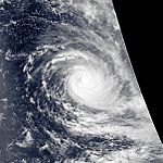
The 1990–91 South-West Indian Ocean cyclone season was fairly quiet, although activity began early and the final named storm formed at a record late date. There were seven named storms classified by the Météo-France office (MFR) on Réunion, as well as three depressions; an additional depression was classified by the Joint Typhoon Warning Center (JTWC), an unofficial warning agency. The JTWC tracked storms in both September and October, although neither affected land. In late November, another short-lived depression formed in the northeastern portion of the basin. Activity remained minimal until January, when Tropical Storm Alison formed in the eastern portion of the basin. Later in the month, Cyclone Bella became the strongest storm of the season, reaching 10‑minute maximum sustained winds of 155 km/h (100 mph). It passed near the island of Rodrigues, becoming the worst cyclone there in 20 years and killing half of the population of one endangered species. Bella also likely caused a cargo ship to go missing with 36 people on board.
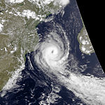
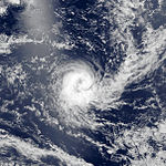
Three storms developed in short succession in the second half of February. Cyclone Cynthia developed rapidly in the Mozambique Channel on February 16 and struck western Madagascar, killing 36 people and ruining local rice harvests. A residual trough after Cynthia dissipated spawned Tropical Storm Debra, which looped in the Mozambique Channel. Toward the end of the month, Tropical Storm Elma exited the basin into the adjacent Australian region, only to re-enter the south-west Indian Ocean and dissipate. Long-lived Cyclone Fatima originated in the Australian basin in late March and changed directions before becoming extratropical. On April 2, a tropical depression struck eastern Madagascar, killing 18 people. The final storm, Gritelle, was named on June 10, the latest on record.
During the season, the Météo-France office (MFR) on Réunion island issued warnings in tropical cyclones within the basin. The agency estimated intensity through the Dvorak technique, and warned on tropical cyclones in the region from the coast of Africa to 90° E, south of the equator. Beginning in November 1990, MFR utilized a high resolution picture transmission station in conjunction with its satellite imagery. This allowed for improved Dvorak ratings, allowing for zooming and adjusting the satellite pictures. The Joint Typhoon Warning Center (JTWC), which is a joint United States Navy – United States Air Force task force, also issued tropical cyclone warnings for the southwestern Indian Ocean. In addition to the named storms, the MFR also tracked four tropical depressions, named A1, A2, A3, and G1.
...
Wikipedia


