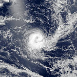
1990–91 Australian region cyclone season
| 1990–91 Australian region cyclone season |

Season summary map
|
| Seasonal boundaries |
| First system formed |
10 December 1990 |
| Last system dissipated |
11 May 1991 |
| Strongest storm |
|
| Name |
Marian |
| • Maximum winds |
210 km/h (130 mph)
(10-minute sustained) |
| • Lowest pressure |
930 hPa (mbar) |
| Seasonal statistics |
| Tropical lows |
12 |
| Tropical cyclones |
10 |
| Severe tropical cyclones |
7 |
| Total fatalities |
56 |
| Total damage |
$63.87 million (1991 USD) |
| Related articles |
|
|
Australian region tropical cyclone seasons
1988–89, 1989–90, 1990–91, 1991–92, 1992–93
|
| Category 1 tropical cyclone (Australian scale) |
| Tropical storm (SSHWS) |
|
|
| Duration |
10 December – 12 December |
| Peak intensity |
65 km/h (40 mph) (10-min) 992 hPa (mbar) |
| Category 4 severe tropical cyclone (Australian scale) |
| Category 2 tropical cyclone (SSHWS) |
|
|
| Duration |
17 December (Crossed 160°E) – 27 December |
| Peak intensity |
165 km/h (100 mph) (10-min) 940 hPa (mbar) |
| Category 3 severe tropical cyclone (Australian scale) |
| Tropical storm (SSHWS) |
|
|
| Duration |
15 February – 21 February |
| Peak intensity |
120 km/h (75 mph) (10-min) 976 hPa (mbar) |
| Category 3 severe tropical cyclone (Australian scale) |
| Tropical storm (SSHWS) |
|
|
| Duration |
21 February – 28 February |
| Peak intensity |
120 km/h (75 mph) (10-min) 976 hPa (mbar) |
| Category 2 tropical cyclone (Australian scale) |
| Tropical storm (SSHWS) |
|
|
| Duration |
24 February – 5 March |
| Peak intensity |
100 km/h (60 mph) (10-min) 980 hPa (mbar) |
| Category 3 severe tropical cyclone (Australian scale) |
| Tropical storm (SSHWS) |
|
|
| Duration |
1 March (Entered basin) – 5 March (Exited basin)
|
| Peak intensity |
150 km/h (90 mph) (10-min) 965 hPa (mbar) |
| Tropical depression (MFR) |
|
|
| Duration |
March 21 – March 22 (Exited basin)
|
| Peak intensity |
55 km/h (35 mph) (10-min) |
| Category 4 severe tropical cyclone (Australian scale) |
| Category 3 tropical cyclone (SSHWS) |
|
|
| Duration |
23 March – 31 March |
| Peak intensity |
175 km/h (110 mph) (10-min) 950 hPa (mbar) |
| Category 5 severe tropical cyclone (Australian scale) |
| Category 2 tropical cyclone (SSHWS) |
|
|
| Duration |
9 April – 19 April |
| Peak intensity |
210 km/h (130 mph) (10-min) 930 hPa (mbar) |
The 1990–91 Australian region cyclone season was a slightly below average cyclone season, with ten tropical cyclones occurring within the region between 90°E and 160°E. The season officially ran from November 1, 1990, to April 30, 1991, with the first disturbance of the season forming on 10 December and the last disturbance moving out of the region during 11 May. Six people were killed by Cyclone Joy when it made landfall on Australia. During the season, tropical cyclones were monitored by the Australian Bureau of Meteorology, who ran Tropical Cyclone Warning Centers (TCWC) in Perth, Darwin, and Brisbane. The United States Joint Typhoon Warning Center (JTWC) and Papua New Guinea National Weather Service also monitored systems within the basin during the season. The JTWC designated systems with a number and either a S or a P suffix depending on which side of 135E. The Bureau of Meteorology and Papua New Guinea national Weather Service both used the Australian Tropical Cyclone Intensity Scale, and estimated windspeeds over a ten-minute period, while the JTWC estimated sustained winds over a one-minute period and are comparable to the Saffir–Simpson Hurricane Scale.
On 8 December, a cluster of clouds developed over the Timor sea and moved towards the south-east, following a large scale mid-latitude forcing event. During the next day, the system developed into a tropical low about 360 km (225 mi) to the south-east of Dili, East Timor while continuing to develop and move towards the south-east. During 10 January as the low became detectable on Darwin's radar, TCWC Darwin reported that the low had developed into a category one tropical cyclone and named it Laurence while reporting that the cyclone had reached its 10-minute peak intensity of 65 km/h (40 mph). Early on 11 January, the JTWC designated Laurence as 05S and initiated warnings on the cyclone with 1-minute windspeeds equivalent to a tropical depression. Later that day TCWC Darwin, reported that Laurence had weakened below cyclone intensity under the influence of vertical wind shear from low-level easterlies while the JTWC reported that Laurence had reached its 1-minute peak intensity of 65 km/h (40 mph). The JTWC kept Laurence at its peak intensity until 2000 WST (1200 UTC) the next day when they reported that the cyclone had become equivalent to a tropical depression. Laurence's remnants moved west over the next few days before dissipating near Rowley Shoals early on 16 December. The only damage that was associated with the cyclone, was the sinking of a fishing boat on 11 December, however TCWC Darwin considers this damage to be indirect because the boat was 150 km (95 mi) away, from the cyclone centre and the radius of gales was less than 55 km (35 mi).
...
Wikipedia


