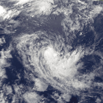
1988–89 Australian region cyclone season
| 1988–89 Australian region cyclone season | |
|---|---|

Season summary map
|
|
| Seasonal boundaries | |
| First system formed | 8 November 1988 |
| Last system dissipated | 12 May 1989 |
| Strongest storm | |
| Name | Orson |
| • Maximum winds | 250 km/h (155 mph) (10-minute sustained) |
| • Lowest pressure | 904 hPa (mbar) |
| Seasonal statistics | |
| Tropical lows | 14 |
| Tropical cyclones | 13 |
| Severe tropical cyclones | 6 |
| Total fatalities | 6 direct |
| Total damage | $93.9 million (1989 USD) |
| Related articles | |
| Category 2 tropical cyclone (Australian scale) | |
| Tropical storm (SSHWS) | |
| Duration | 8 November – 11 November (Exited basin) |
|---|---|
| Peak intensity | 95 km/h (60 mph) (10-min) |
| Category 3 severe tropical cyclone (Australian scale) | |
| Category 2 tropical cyclone (SSHWS) | |
| Duration | 12 December – 19 December |
|---|---|
| Peak intensity | 130 km/h (80 mph) (10-min) 960 hPa (mbar) |
| Category 1 tropical cyclone (Australian scale) | |
| Duration | 28 December – 1 January (Exited basin) |
|---|---|
| Peak intensity | 85 km/h (50 mph) (10-min) 988 hPa (mbar) |
| Category 1 tropical cyclone (Australian scale) | |
| Duration | 23 January – 2 February |
|---|---|
| Peak intensity | 75 km/h (45 mph) (10-min) 990 hPa (mbar) |
| Category 3 severe tropical cyclone (Australian scale) | |
| Category 1 tropical cyclone (SSHWS) | |
| Duration | 3 February – 11 February |
|---|---|
| Peak intensity | 140 km/h (85 mph) (10-min) 955 hPa (mbar) |
| Category 1 tropical cyclone (Australian scale) | |
| Tropical storm (SSHWS) | |
| Duration | 13 February – 19 February (Exited basin) |
|---|---|
| Peak intensity | 85 km/h (50 mph) (10-min) 988 hPa (mbar) |
| Category 4 severe tropical cyclone (Australian scale) | |
| Category 4 tropical cyclone (SSHWS) | |
| Duration | 13 February (Entered basin) – 17 February (Exited basin) |
|---|---|
| Peak intensity | 185 km/h (115 mph) (10-min) 925 hPa (mbar) |
| Tropical low (Australian scale) | |
| Tropical storm (SSHWS) | |
| Duration | 23 February – 25 February |
|---|---|
| Peak intensity | 85 km/h (50 mph) (1-min) 989 hPa (mbar) |
| Category 1 tropical cyclone (Australian scale) | |
| Tropical storm (SSHWS) | |
| Duration | 2 March – 5 March |
|---|---|
| Peak intensity | 65 km/h (40 mph) (10-min) 995 hPa (mbar) |
The 1988–89 Australian region cyclone season was a slightly above average tropical cyclone season. It officially started on 1 November 1988, and officially ended on 30 April 1989. The regional tropical cyclone operational plan defines a "tropical cyclone year" separately from a "tropical cyclone season"; the "tropical cyclone year" began on 1 July 1988 and ended on 30 June 1989.
On 5 November, the JTWC started to monitor a tropical disturbance, that was located about 840 km (520 mi) to the southeast of Jakarta, Indonesia. Over the next 24 hours the disturbance remained near stationary before moving slowly towards the north-west over the next few days. The JTWC then initiated advisories on Tropical Cyclone 02S during 8 November, with 1-minute sustained windspeeds equivalent to a tropical storm on the SSHS. During that day while 02S continued to move towards the west, 02S intensified quickly to obtain 1-minute sustained windspeeds of 100 km/h (65 mph). The system continued to move westwards without intensifying any further until it moved into the South-West Indian Ocean during 11 November where it was named Barisaona, by the Mauritius Meteorological service. According to the Reunion Meteorological Service, Barisaona ultimately peaked on 16 November with 10-minute sustained windspeeds of 140 km/h (85 mph), while the JTWC estimated that the cyclone peaked on 17 November with 1-minute windspeeds of 185 km/h (115 mph). The cyclone then dissipated around 23 November.
While Barisaona was in the Australian region TCWC Perth did not monitor it as a named storm. However, when the system was added to their database, it was estimated that while it was in the Australian region it had peaked as a Category 2 tropical cyclone with 10-minute windspeeds of 95 km/h (60 mph).
Ilona developed off the Western Australian coast on 12 December 1988 and made landfall northeast of Onslow, Western Australia on 17 December 1988. Ilona attained a minimum central pressure of 960 mb and maximum wind speed of 85 knots.
The tropical low that was to develop into Tropical Cyclone Delilah, was first noted within the South Pacific convergence zone during 28 December to the northeast of Townsville in Queensland, Australia. Over the next few days the system moved eastwards and slowly intensified further before TCWC Brisbane named it Delilah, during 1 January after it had developed into a category 1 tropical cyclone on the Australian scale. Later that day as the system started to move south-eastwards it crossed 160°E and moved out of the Australian region into the South Pacific basin.
...
Wikipedia


