1990 Pacific typhoon season
| 1990 Pacific typhoon season | |
|---|---|
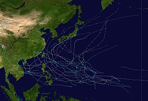
Season summary map
|
|
| Seasonal boundaries | |
| First system formed | January 12, 1990 |
| Last system dissipated | December 23, 1990 |
| Strongest storm | |
| Name | Flo |
| • Maximum winds | 220 km/h (140 mph) (10-minute sustained) |
| • Lowest pressure | 890 hPa (mbar) |
| Seasonal statistics | |
| Total depressions | 35 |
| Total storms | 32 |
| Typhoons | 18 |
| Super typhoons | 4 |
| Total fatalities | >1,576 |
| Total damage | $2.7 billion (1990 USD) |
| Related articles | |
| Severe tropical storm (JMA) | |
| Category 1 typhoon (SSHWS) | |
| Duration | January 12 – January 17 |
|---|---|
| Peak intensity | 100 km/h (65 mph) (10-min) 980 hPa (mbar) |
| Tropical storm (JMA) | |
| Tropical storm (SSHWS) | |
| Duration | April 28 – May 4 |
|---|---|
| Peak intensity | 65 km/h (40 mph) (10-min) 998 hPa (mbar) |
| Typhoon (JMA) | |
| Category 2 typhoon (SSHWS) | |
| Duration | May 15 – May 19 |
|---|---|
| Peak intensity | 130 km/h (80 mph) (10-min) 965 hPa (mbar) |
| Tropical depression (CMA) | |
| Duration | May 20 – May 23 |
|---|---|
| Peak intensity | 55 km/h (35 mph) (10-min) 1000 hPa (mbar) |
| Tropical depression (CMA) | |
| Duration | May 24 – May 28 |
|---|---|
| Peak intensity | 55 km/h (35 mph) (10-min) 1000 hPa (mbar) |
| Tropical depression (HKO) | |
| Tropical depression (SSHWS) | |
| Duration | June 14 – June 16 |
|---|---|
| Peak intensity | 55 km/h (35 mph) (10-min) 995 hPa (mbar) |
| Severe tropical storm (JMA) | |
| Tropical storm (SSHWS) | |
| Duration | June 14 – June 19 |
|---|---|
| Peak intensity | 100 km/h (65 mph) (10-min) 980 hPa (mbar) |
| Typhoon (JMA) | |
| Category 2 typhoon (SSHWS) | |
| Duration | June 16 – June 25 |
|---|---|
| Peak intensity | 120 km/h (75 mph) (10-min) 970 hPa (mbar) |
| Typhoon (JMA) | |
| Category 4 typhoon (SSHWS) | |
| Duration | June 20 – June 30 |
|---|---|
| Peak intensity | 150 km/h (90 mph) (10-min) 950 hPa (mbar) |
The 1990 Pacific typhoon season has no official bounds; it ran year-round in 1990, but most tropical cyclones tend to form in the northwestern Pacific Ocean between May and November. These dates conventionally delimit the period of each year when most tropical cyclones form in the northwestern Pacific Ocean.
The scope of this article is limited to the Pacific Ocean, north of the equator and west of the international date line. Storms that form east of the date line and north of the equator are called hurricanes; see 1990 Pacific hurricane season. Tropical Storms formed in the entire west Pacific basin were assigned a name by the Joint Typhoon Warning Center. Tropical depressions in this basin have the "W" suffix added to their number. Tropical depressions that enter or form in the Philippine area of responsibility are assigned a name by the Philippine Atmospheric, Geophysical and Astronomical Services Administration or PAGASA. This can often result in the same storm having two names.
35 tropical cyclones formed this year in the Western Pacific, of which 32 became tropical storms. 18 storms reached typhoon intensity, of which 4 reached super typhoon strength.
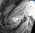
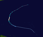
On January 12, both the JMA and the JTWC identified a tropical depression in the northwest Pacific Ocean. The depression intensified over the period of a day to become a tropical storm on January 13, when it received the name Koryn from the JTWC. According to them, but not the JMA, Koryn reached hurricane-equivalent strength on January 15, when it peaked in intensity. The storm then weakened quite rapidly until it became extratropical on January 17, at 0000 UTC.
Tropical Storm Lewis was a minimal tropical storm that only held said intensity for two days.
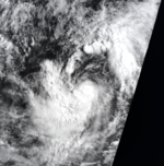
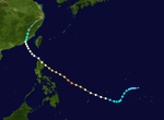
A tropical disturbance trekked across the Philippines in mid June, upon entering the South China Sea a depression formed. The depression was upgraded to Tropical Storm Nathan on June 16. Tropical Storm Nathan reached peak intensity of 65 mph (100 km/h) shortly before striking Hainan Island. In the South China Sea the Chinese ship Tien Fu sank killing 4 people. In southern China torrential rains caused flooding in Guangdong and Zhanjian Provinces killing 10 people, two people drowned in Macau due to high waves. Tropical Storm Nathan then continued northwestwards making a final landfall near the Vietnam/China border.
...
Wikipedia

