1991 Pacific typhoon season
| 1991 Pacific typhoon season | |
|---|---|

Season summary map
|
|
| Seasonal boundaries | |
| First system formed | March 5, 1991 |
| Last system dissipated | December 5, 1991 |
| Strongest storm | |
| Name | Yuri |
| • Maximum winds | 220 km/h (140 mph) (10-minute sustained) |
| • Lowest pressure | 895 hPa (mbar) |
| Seasonal statistics | |
| Total depressions | 38 |
| Total storms | 28 |
| Typhoons | 17 |
| Super typhoons | 5 |
| Total fatalities | ~5,505 |
| Total damage | > $10.1 billion (1991 USD) |
| Related articles | |
| Severe tropical storm (JMA) | |
| Tropical storm (SSHWS) | |
| Duration | March 5 – March 16 |
|---|---|
| Peak intensity | 95 km/h (60 mph) (10-min) 985 hPa (mbar) |
| Typhoon (JMA) | |
| Category 1 typhoon (SSHWS) | |
| Duration | March 20 – March 27 |
|---|---|
| Peak intensity | 120 km/h (75 mph) (10-min) 970 hPa (mbar) |
| Tropical storm (JMA) | |
| Tropical storm (SSHWS) | |
| Duration | April 23 – April 28 |
|---|---|
| Peak intensity | 85 km/h (50 mph) (10-min) 994 hPa (mbar) |
| Typhoon (JMA) | |
| Category 5 super typhoon (SSHWS) | |
| Duration | May 5 – May 17 |
|---|---|
| Peak intensity | 185 km/h (115 mph) (10-min) 915 hPa (mbar) |
| Typhoon (JMA) | |
| Category 3 typhoon (SSHWS) | |
| Duration | June 12 – June 17 |
|---|---|
| Peak intensity | 150 km/h (90 mph) (10-min) 950 hPa (mbar) |
| Typhoon (JMA) | |
| Category 1 typhoon (SSHWS) | |
| Duration | July 9 – July 15 |
|---|---|
| Peak intensity | 120 km/h (75 mph) (10-min) 970 hPa (mbar) |
| Typhoon (JMA) | |
| Category 4 typhoon (SSHWS) | |
| Duration | July 14 – July 20 |
|---|---|
| Peak intensity | 175 km/h (110 mph) (10-min) 930 hPa (mbar) |
| Severe tropical storm (JMA) | |
| Category 1 typhoon (SSHWS) | |
| Duration | July 19 – July 25 |
|---|---|
| Peak intensity | 110 km/h (70 mph) (10-min) 980 hPa (mbar) |
| Typhoon (JMA) | |
| Category 2 typhoon (SSHWS) | |
| Duration | July 21 – July 30 |
|---|---|
| Peak intensity | 150 km/h (90 mph) (10-min) 940 hPa (mbar) |
The 1991 Pacific typhoon season has no official bounds; it ran year-round in 1991, but most tropical cyclones tend to form in the northwestern Pacific Ocean between May and November. These dates conventionally delimit the period of each year when most tropical cyclones form in the northwestern Pacific Ocean.
The scope of this article is limited to the Pacific Ocean, north of the equator and west of the international date line. Storms that form east of the date line and north of the equator are called hurricanes; see 1991 Pacific hurricane season. Tropical Storms formed in the entire west pacific basin were assigned a name by the Joint Typhoon Warning Center. Tropical depressions in this basin have the "W" suffix added to their number. Tropical depressions that enter or form in the Philippine area of responsibility are assigned a name by the Philippine Atmospheric, Geophysical and Astronomical Services Administration or PAGASA. This can often result in the same storm having two names.
32 tropical cyclones formed this year in the Western Pacific, of which 30 became tropical storms. 17 storms reached typhoon intensity, of which 5 reached super typhoon strength.
On March 17, a cluster of thunderstorms grouped together which formed a low pressure area far east of the Mariana islands. The low pressure area rapidly intensified and became a tropical storm 4 days after formation. Favorable conditions allowed the system to continue to intensify into a Category 1 typhoon. High wind shear on March 25 caused the system to weakened, and it transitioned into an extratropical cyclone.
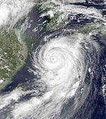
On May 3 an area of disturbed area formed south east of the Mariana Islands. A day later the system strengthened into a tropical depression, and continued to intensify into typhoon status four days later. The system showed annular characteristics on May 11, showing an axisymmetric shape. Walt reached peak intensity on May 12, before showing a distinct eyewall replacement cycle lasting four hours from late May 13 to May 14. When the eyewall replacement cycle was over, a new, larger eye measuring 65 kilometers across formed. Walt soon turned north east, becoming extratropical on May 17, before merging with another extratropical cyclone north east of Japan.
...
Wikipedia

