1992 Pacific typhoon season
| 1992 Pacific typhoon season | |
|---|---|

Season summary map
|
|
| Seasonal boundaries | |
| First system formed | January 4, 1992 |
| Last system dissipated | November 29, 1992 |
| Strongest storm | |
| Name | Gay |
| • Maximum winds | 205 km/h (125 mph) (10-minute sustained) |
| • Lowest pressure | 900 hPa (mbar) |
| Seasonal statistics | |
| Total depressions | 35 |
| Total storms | 31 |
| Typhoons | 16 |
| Super typhoons | 5 |
| Total fatalities | 385 |
| Total damage | $2.78 billion (1992 USD) |
| Related articles | |
| Severe tropical storm (JMA) | |
| Category 1 typhoon (SSHWS) | |
| Duration | January 4 – January 15 |
|---|---|
| Peak intensity | 100 km/h (65 mph) (10-min) 980 hPa (mbar) |
| Tropical storm (JMA) | |
| Tropical storm (SSHWS) | |
| Duration | February 3 (Entered basin) – February 8 |
|---|---|
| Peak intensity | 85 km/h (50 mph) (10-min) 990 hPa (mbar) |
| Typhoon (JMA) | |
| Category 4 typhoon (SSHWS) | |
| Duration | June 22 – June 30 |
|---|---|
| Peak intensity | 165 km/h (105 mph) (10-min) 940 hPa (mbar) |
| Typhoon (JMA) | |
| Category 1 typhoon (SSHWS) | |
| Duration | June 24 – July 2 |
|---|---|
| Peak intensity | 130 km/h (80 mph) (10-min) 965 hPa (mbar) |
| Tropical depression (HKO) | |
| Tropical storm (SSHWS) | |
| Duration | June 25 – July 4 |
|---|---|
| Peak intensity | 55 km/h (35 mph) (10-min) 997 hPa (mbar) |
| Typhoon (JMA) | |
| Category 1 typhoon (SSHWS) | |
| Duration | July 8 – July 14 |
|---|---|
| Peak intensity | 130 km/h (80 mph) (10-min) 965 hPa (mbar) |
| Tropical storm (JMA) | |
| Tropical storm (SSHWS) | |
| Duration | July 14 – July 18 |
|---|---|
| Peak intensity | 65 km/h (40 mph) (10-min) 1000 hPa (mbar) |
| Severe tropical storm (JMA) | |
| Category 1 typhoon (SSHWS) | |
| Duration | July 17 – July 24 |
|---|---|
| Peak intensity | 100 km/h (65 mph) (10-min) 980 hPa (mbar) |
| Tropical storm (JMA) | |
| Tropical storm (SSHWS) | |
| Duration | July 24 – July 28 |
|---|---|
| Peak intensity | 75 km/h (45 mph) (10-min) 996 hPa (mbar) |
The 1992 Pacific typhoon season had no official bounds; it ran year-round in 1992. Despite this, most tropical cyclones tend to form in the northwestern Pacific Ocean between May and November. These dates conventionally delimit the period of each year when most tropical cyclones form in the northwestern Pacific Ocean.
The scope of this article is limited to the Pacific Ocean, north of the equator and west of the International Date Line. Storms that formed north of the equator and east of the Date Line in 1992 are part of the 1992 Pacific hurricane season. In the West Pacific basin, tropical depressions have the "W" suffix added to their number. Storms reaching tropical storm intensity of 34 kn (63 km/h) sustained winds were assigned a name by the Joint Typhoon Warning Center (JTWC). Storms with sustained winds exceeding 64 knots (119 km/h) are called typhoons, while intense typhoons with sustained winds exceeding 130 knots (240 km/h) are designated super typhoons by the JTWC (see tropical cyclone scales).
Furthermore, tropical depressions that enter or form in the Philippine Area of Responsibility are assigned an internal name by the Philippine Atmospheric, Geophysical and Astronomical Services Administration (PAGASA). This can often result in the same storm having two names.
There were a total of 33 tropical cyclones in the Western Pacific in 1992. 32 of these formed within the basin, and 1 storm, Tropical Storm Ekeka, formed in the Central Pacific basin, crossing the Date Line to enter the Western Pacific. Out of the 33, 32 became named tropical storms, 21 reached typhoon intensity, and 5 reached super typhoon strength. Storms are listed in numerical ascending order by their JTWC tropical depression numbers except for Ekeka, and not in alphabetical order of names. Thus, Tropical Storm Zack (22W) is listed before Super Typhoon Yvette (23W).
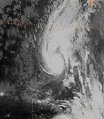
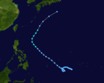
Axel formed as a tropical storm on January 4. It then curved and reached tropical storm strength. Axel continued to intensify, and it reached its peak as a severe tropical storm. Then, Axel weakened to a tropical storm. Axel continued to weak further until it was a tropical depression. It curve northeast until it was dissipated on January 15.
...
Wikipedia


