Île Notre-Dame
 |
|
| Geography | |
|---|---|
| Location | Saint Lawrence River |
| Coordinates | 45°30′15″N 73°31′35″W / 45.50417°N 73.52639°WCoordinates: 45°30′15″N 73°31′35″W / 45.50417°N 73.52639°W |
| Archipelago | Hochelaga Archipelago |
| Administration | |
| Province |
|
| City |
|
| Borough | Ville-Marie |
| Demographics | |
| Population | 0 |
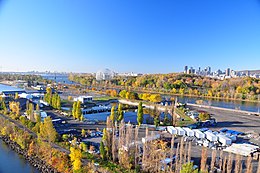
Notre Dame Island (French: Île Notre-Dame) is an artificial island located in the Saint Lawrence River in Montreal, Quebec, Canada. It is located immediately east of Saint Helen's Island and west of the Saint Lawrence Seaway and the city of Saint-Lambert on the south shore. Together with Saint Helen's Island, it makes up Parc Jean-Drapeau, which forms part of the Hochelaga Archipelago. To the southwest, the island is connected to the embankment separating the seaway and Lachine Rapids.
Parc Jean-Drapeau is officially recognized as a registered leg of the Route Verte and Trans Canada Trail.
It houses the Circuit Gilles Villeneuve, host of the Canadian Grand Prix of Formula One.
Notre Dame Island was built in ten months from 15 million tons of rock excavated for the Montreal Metro in 1965. It was created for Expo 67 to celebrate Canada's centennial.
Nearly all of the remaining Expo 67 pavilions were demolished in 1975 to make way for a long rowing and canoeing basin for Montreal's 1976 Summer Olympics. The Olympic Basin is still the biggest artificial rowing basin in North America. The former pavilion of France and the pavillon of Quebec were gutted, redecorated, and became the Montreal Casino, a large gambling establishment owned and operated by the Government of Quebec. The Canadian Pavilion now serves the administration of the Société du parc Jean-Drapeau, a para-municipal body of the city of Montreal, manager of Parc Jean-Drapeau.
...
Wikipedia
