Saint Lawrence Seaway
| St. Lawrence Seaway | |
|---|---|
 |
|
| Specifications | |
| Length | 370 miles (600 km) |
| Maximum boat length | 740 ft 0 in (225.6 m) |
| Maximum boat beam | 78 ft 0 in (23.8 m) |
| Locks | 15 |
| Maximum height above sea level | 570 ft (170 m) |
| Status | Open |
| History | |
| Construction began | 1954 |
| Date of first use | April 25 |
| Date completed | 1959 |
| Geography | |
| Start point | Port Colborne, Ontario |
| End point | Montreal, Quebec |
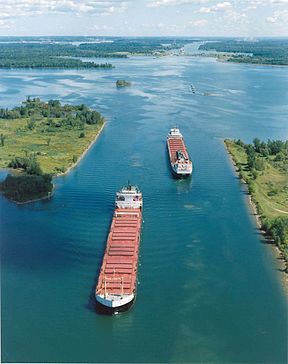
The Saint Lawrence Seaway (French: la Voie Maritime du Saint-Laurent) is a system of locks, canals and channels in Canada and the United States that permit ocean-going vessels to travel from the Atlantic Ocean to the Great Lakes of North America, as far inland as the western end of Lake Superior. The Seaway is named for the Saint Lawrence River, which flows from Lake Ontario to the Atlantic Ocean. Legally, the Seaway extends from Montreal, Quebec, to Lake Erie and includes the Welland Canal.
This section upstream of the Seaway is not a continuous canal; rather, it consists of several stretches of navigable channels within the river, a number of locks, and canals along the banks of the St. Lawrence River to bypass several rapids and dams along the way. A number of the locks are managed by the Saint Lawrence Seaway Management Corporation in Canada, and others in the United States by the Saint Lawrence Seaway Development Corporation; the two bodies together advertise the Seaway as part of "Highway H2O". The section of the river downstream of Montreal, which is fully within Canadian jurisdiction, is regulated by the offices of Transport Canada in the Port of Quebec.
...
Wikipedia
