Ville-Marie, Montreal
| Ville-Marie | ||
|---|---|---|
| Borough of Montreal | ||

A view of McGill College Avenue in December.
|
||
|
||
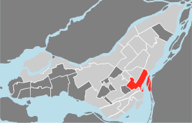
 Location of Ville-Marie on the Island of Montreal. (Grey areas indicate demerged municipalities). |
||
| Country |
|
|
| Province |
|
|
| Region |
|
|
| Established | January 01, 2002 | |
| Electoral Districts Federal |
Ville-Marie—Le Sud-Ouest—Île-des-Sœurs Laurier—Sainte-Marie Outremont |
|
| Provincial |
Westmount–Saint-Louis Sainte-Marie–Saint-Jacques Hochelaga-Maisonneuve Saint-Henri–Sainte-Anne |
|
| Government | ||
| • Type | Borough | |
| • Mayor | Denis Coderre | |
| • Federal MP(s) |
Marc Miller (LIB) Hélène Laverdière (NDP) Thomas Mulcair (NDP) |
|
| • Quebec MNA(s) |
Jacques Chagnon (PLQ) Manon Massé (QS) Carole Poirier (PQ) Marguerite Blais (PLQ) |
|
| Area | ||
| • Total | 16.5 km2 (6.4 sq mi) | |
| Population (2011) | ||
| • Total | 84,013 | |
| • Density | 5,085.5/km2 (13,171/sq mi) | |
| Time zone | EST (UTC-5) | |
| • Summer (DST) | EDT (UTC-4) | |
| Area code(s) | (514) and (438) | |
| Access Routes |
|
|
| Website | www.ville.montreal.qc.ca/villemarie | |
Ville-Marie is the name of a borough (arrondissement) in the centre of the city of Montreal, Quebec. The borough is named after Fort Ville-Marie, the French settlement that would later become Montreal (now Old Montreal), which was located within the present-day borough. Old Montreal is a National Historic Site of Canada.
The borough comprises all of downtown Montreal, including the Quartier des spectacles; Old Montreal and the Old Port; the Centre-Sud area; most of Mount Royal Park as well as Saint Helen's Island and Île Notre-Dame.
In 2011, it had a population of 84,013 and an area of 16.5 square kilometres (6.4 sq mi).
It is bordered by the city of Westmount (along Atwater Street) to the west and the boroughs of Le Sud-Ouest (along the Ville-Marie Autoroute, Guy and Notre-Dame streets, and the Bonaventure Autoroute) to the southwest, Mercier–Hochelaga-Maisonneuve (along the CP rail lines) to the east, Le Plateau-Mont-Royal (along Sherbrooke, University streets, and Pine and Park avenues) to the northeast, and Outremont and Côte-des-Neiges—Notre-Dame-de-Grâce (along the border of Mount Royal Park) to the north. It is bounded on the south by the Saint Lawrence River.
...
Wikipedia
