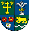
Zilina Region
|
Žilina Region Žilinský kraj |
|||
|---|---|---|---|
| Region | |||
|
|||
 Location of the Žilina Region in Slovakia |
|||
| Country | Slovakia | ||
| Capital | Žilina | ||
| Area | |||
| • Total | 6,808.58 km2 (2,628.81 sq mi) | ||
| Highest elevation | 2,495 m (8,186 ft) | ||
| Lowest elevation | 301 m (988 ft) | ||
| Population (2011 census) | |||
| • Total | 688,851 | ||
| • Density | 100/km2 (260/sq mi) | ||
| Website | www |
||
The Žilina Region (Slovak: Žilinský kraj; Polish: Kraj żyliński) is one of the eight Slovak administrative regions and consists of 11 districts (okresy) and 315 municipalities, from which 18 have a town status. The region was established in 1923, however, in its present borders exists from 1996. It is more industrial region with several large towns. Žilina is region administrative center and a strong cultural environment is in Martin.
It is located in northern Slovakia and has an area of 6,804 km² and a population of 688,851 (2011). The whole area is mountainous, belonging to the Western Carpathians. Some of the mountain ranges in the region include Javorníky, the Lesser Fatra and the Greater Fatra in the west, Oravská Magura, Chočské vrchy, Low Tatras and Western Tatras in the east. Whole area belongs to the Váh river basin. Some of its left tributaries are Turiec and Rajčanka rivers and its right tributaries Belá, Orava and Kysuca. National parks on the region's territory are the Lesser, Greater Fatra, Low Tatras and Tatra; landscape protected areas are Strážovské vrchy, Kysuce and Horná Orava. The region borders Prešov Region in the east, Banská Bystrica Region in the south, Trenčín Region in the south-west and west, Czech Zlín Region and Moravian-Silesian regions in the north-west and Polish Silesian and Lesser Poland voivodeships in the north and north-east.
...
Wikipedia


