Wayne County, Michigan
| Wayne County, Michigan | |||
|---|---|---|---|
| County | |||
| County of Wayne | |||

The Guardian Building which serves as the county headquarters
|
|||
|
|||
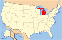
 Location in the U.S. state of Michigan |
|||
 Michigan's location in the U.S. |
|||
| Founded | August 15, 1796 (created) 1815 (organized) |
||
| Named for | Anthony Wayne | ||
| Seat | Detroit | ||
| Largest city | Detroit | ||
| Area | |||
| • Total | 673 sq mi (1,743 km2) | ||
| • Land | 612 sq mi (1,585 km2) | ||
| • Water | 61 sq mi (158 km2), 9.0% | ||
| Population (est.) | |||
| • (2014) | 1,764,804 | ||
| • Density | 2,974/sq mi (1,148/km²) | ||
| Congressional districts | 11th, 12th, 13th, 14th | ||
| Time zone | Eastern: UTC-5/-4 | ||
| Website | www |
||
Wayne County is the most populous county in the U.S. state of Michigan. As of the 2010 census, its population was 1,820,584, making it the 19th-most populous county in the United States. The 2014 Census update listed the county's population at 1,764,804. The county seat is Detroit, the most populous city in Michigan and 18th-most populous city in the United States. The county was founded in 1796 and organized in 1815.
Wayne County is included in the Detroit-Warren-Dearborn, MI Metropolitan Statistical Area. It is one of several American counties named after Revolutionary War General Anthony Wayne.
Wayne County was the sixth county in the Northwest Territory, formed 15 August 1796 from portions of territorial Hamilton County, territorial Knox County and unorganized territory. It was named for the American general "Mad Anthony" Wayne. It originally encompassed the entire area of the Lower Peninsula of Michigan, most of the Upper Peninsula, as well as smaller sections that are now part of northern Ohio, Indiana and Illinois. By proclamation of the Territorial Secretary and Acting Governor, Winthrop Sargent, on August 15, 1796, the boundaries of Wayne County were declared to begin at the mouth of the Cuyahoga River then west to Fort Wayne, then to the southernmost point of Lake Michigan and along the western shore north to the territorial boundary in Lake Superior and then along the territorial boundary through Lake Huron, Lake St. Clair, and Lake Erie back to the starting point.
...
Wikipedia


