Waterloo (electoral district)
|
|
|||
|---|---|---|---|

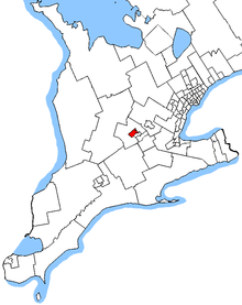
Waterloo in relation to southern Ontario ridings (2013 boundaries)
|
|||
| Federal electoral district | |||
| Legislature | House of Commons | ||
| MP |
Liberal |
||
| District created | 1966 | ||
| First contested | 1968 | ||
| Last contested | 2015 | ||
| District webpage | profile, map | ||
| Demographics | |||
| Population (2011) | 103,192 | ||
| Electors (2015) | 77,312 | ||
| Area (km²) | 78 | ||
| Pop. density (per km²) | 1,323 | ||
| Census divisions | Waterloo | ||
| Census subdivisions | Waterloo, Kitchener | ||
Waterloo is a federal electoral district in the Waterloo Region of Ontario, Canada, that was represented in the House of Commons of Canada from 1968 to 1997 (from 1973 to 1976, it was known as Waterloo—Cambridge) and that is again represented in the House of Commons since the 2015 federal election as a result of the Canadian federal electoral redistribution, 2012.
The Waterloo electoral district contains all of the city of Waterloo plus the Bridgeport neighbourhood of Kitchener.
The Waterloo electoral district was created in 1966 from parts of Waterloo North and Waterloo South electoral districts. It initially comprised the City of Galt (now part of Cambridge), the City of Waterloo and the Townships of North Dumfries and Waterloo.
After the amalgamation of the City of Galt with the Towns of Preston and Hespeler into the City of Cambridge in 1973, the name of the electoral district was changed to Waterloo—Cambridge, The boundaries of the district were not changed.
In 1976, Waterloo—Cambridge was abolished when it was redistributed among Cambridge, Kitchener, and a new Waterloo electoral district.
The new Waterloo electoral district was created from parts of the Kitchener, Perth—Wilmot, Waterloo—Cambridge, and Wellington—Grey—Dufferin—Waterloo electoral districts. It comprised the Townships of Wellesley, Wilmot and Woolwich, the City of Waterloo, and parts of the City of Kitchener.
...
Wikipedia
