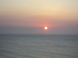
Timor Sea
| Timor Sea | |
|---|---|

The Timor Sea at Vessoru, East Timor
|
|

Map
|
|
| Coordinates | 10°S 127°E / 10°S 127°ECoordinates: 10°S 127°E / 10°S 127°E |
| Type | Sea |
| Catchment area | East Timor, Australia, Indonesia |
| Surface area | 610,000 km2 (240,000 sq mi) |
| Average depth | 406 m (1,332 ft) |
| Max. depth | 3,200 m (10,500 ft) |
| Islands | Tiwi Islands, Ashmore and Cartier Islands |
| Trenches | Timor Trough |
| Settlements | Darwin, Northern Territory |
The Timor Sea (Indonesian: Laut Timor; Portuguese: Mar de Timor) is a relatively shallow sea bounded to the north by the island of Timor, to the east by the Arafura Sea, to the west of Australia.
The sea contains a number of reefs, uninhabited islands and significant hydrocarbon reserves. International disputes emerged after the reserves were discovered resulting in the signing of the Timor Sea Treaty.
The Timor Sea was hit by the worst oil spill for 25 years in 2009.
It is possible that Australia's first inhabitants crossed the Timor Sea from Indonesia at a time when sea levels were lower.
The waters to the east are known as the Arafura Sea. The Timor Sea is adjacent to three substantial inlets on the north Australian coast, the Joseph Bonaparte Gulf, Beagle Gulf and the Van Diemen Gulf. The Australian city of Darwin is the only large city to adjoin the sea. The small town of Wyndham is located on the west arm of Cambridge Gulf, an inlet of Joseph Bonaparte Gulf.
Rivers that enter the Timor Sea from the Northern Territory include Fish River, King River, Dry River, Victoria River and the Alligator Rivers. Rivers in the Kimberley region that flow into the Timor Sea include the Ord River, Forrest River, Pentecost River and Durack River.
...
Wikipedia
