Ord River
| Ord River | |
|---|---|

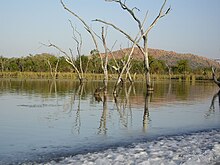
Ord River from a boat
|
|
| Country | Australia |
| Basin features | |
| Main source | Kimberley Plateau 531 metres (1,742 ft) |
| River mouth |
Cambridge Gulf, Timor Sea sea level |
| Basin size | 46,100 square kilometres (17,799 sq mi) |
| Tributaries |
|
| Physical characteristics | |
| Length | 650 km (400 mi) |
| Discharge |
|
The Ord River is a 320-kilometre (200 mi) long river in the Kimberley region of Western Australia. The river's catchment covers 46,100 square kilometres (17,799 sq mi).
The lower Ord river and the conjunction with Cambridge Gulf create the most northern estuarine environment in Western Australia
The Ord River Irrigation Scheme was built in stages during the 20th century. Australia's largest artificial lake by volume, Lake Argyle was completed in 1972. The lower reaches of the river support an important wetland area known as the Ord River Floodplain, a protected area which contains numerous mangrove forests, lagoons, creeks, flats and extensive floodplains.
It was named in honour of Sir Harry St. George Ord GCMG, CB, RE, Governor of Western Australia from 1877 to 1880, by Alexander Forrest on 2 August 1879. Forrest's journal states.
We are still 300 miles from the telegraph line, and cannot of course tell what difficulties may not yet be in store for us, so I feel bound to push on, at the same time no one can regret more than I do that I am unable to follow this magnificent stream to its mouth which I have no doubt will be found in Cambridge Gulf–the whole of its waters in that case being in Western Australian territory. I have named this river the Ord, after His Excellency the Governor of Western Australia, who has taken so great an interest in this expedition. Marked a tree F 158.
The headwaters of the Ord river are located below the 983 metre Mount Wells and initially flows east and around the edge of Purnululu National Park before heading north through Lake Argyle then passing west of Kununurra and discharging into the Cambridge Gulf, which is at the southern extremity of the Joseph Bonaparte Gulf, Timor Sea. The river has 35 tributaries of which the five longest are Bow River, Nicholson River, Dunham River, Panton River and Negri Rivers.
...
Wikipedia
