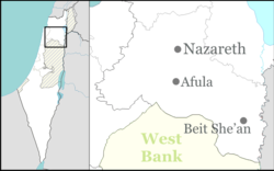
Tamra, Jezreel Valley
| Tamra | |
|---|---|

Tamra
|
|
| Coordinates: 32°38′5″N 35°24′8″E / 32.63472°N 35.40222°ECoordinates: 32°38′5″N 35°24′8″E / 32.63472°N 35.40222°E | |
| Grid position | 188/226 PAL |
| District | Northern |
| Council | Gilboa |
| Population (2015) | 1,513 |
Tamra (Arabic: طمرة; Hebrew: טַמְרָה or תַמְרָה) is an Arab village in north-eastern Israel. Located in the Jezreel Valley, it falls under the jurisdiction of Gilboa Regional Council. In 2015 it had a population of 1,513.
The name Tamra is dervied from the Arabic to make a pit for storing corn & c.
Remains from the Iron Age I era have been excavated. Remains from the Iron Age II, the Late Persian – Early Hellenistic, Roman and Byzantine eras have been found here.
A village was here in the Byzantine period; tombs and remnants of two churches have been found. In the Byzantine and early Islamic eras, there was an agricultural settlement here.
Remains from the Early Islamic (Umayyad/Abbasid) (including Umayyad glass vessels and Abbasid pottery and a lamp)
Remains dating to the Umayyad era (seventh–eighth centuries CE) have been excavated, together with housing remains dating to the Early Abbasid period (late eighth and early ninth centuries CE).
...
Wikipedia

