Stormont, Dundas and Glengarry United Counties
| Stormont, Dundas and Glengarry | |
|---|---|
| United counties (upper-tier) | |
| United Counties of Stormont, Dundas and Glengarry | |
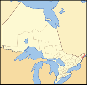
 Location of Stormont Dundas and Glengarry United Counties |
|
| Coordinates: 45°10′N 74°57′W / 45.167°N 74.950°WCoordinates: 45°10′N 74°57′W / 45.167°N 74.950°W | |
| Country |
|
| Province |
|
| Region | Eastern Ontario |
| Established | 1850 |
| County seat | Cornwall |
| Municipalities | |
| Government | |
| • Warden | Jamie MacDonald |
| Area | |
| • Land | 3,296.97 km2 (1,272.97 sq mi) |
| Population (2011) | |
| • Total | 64,824 |
| • Density | 20.0/km2 (52/sq mi) |
| • Population (census division) | 111,164 |
| Time zone | EST (UTC-5) |
| • Summer (DST) | EDT (UTC-4) |
| Website | www.sdg.on.ca |
The United Counties of Stormont, Dundas and Glengarry is an upper-tier municipality in the Canadian province of Ontario that comprises three historical counties and excludes the City of Cornwall and the Mohawk Nation of Akwesasne. However, both Cornwall and Akwesasne form part of a larger census division named for the United Counties of Stormont, Dundas and Glengarry. The municipality's administrative office is located within Cornwall.
The united counties border Quebec to the east and New York in the United States to the south. The sovereign Mohawk Nation of Akwesasne straddles both borders, thus including territory partly within the united counties, Quebec and New York.
The area along the Saint Lawrence River had been settled by indigenous peoples for thousands of years. About 2,000 years ago, the Point Peninsula Complex people built earthen mounds, such as those at Serpent Mounds Park and Cameron's Point. They were gradually replaced about 1000–1300 CE by the Owasco people, who had migrated northward. They practiced a more settled form of agriculture.
These people are believed to have developed into the Iroquoian-speaking people, of which the St. Lawrence Iroquoians are identified as having settled along the river valley of the same name. They spoke Laurentian, practiced agriculture, and built fortified villages, such as those visited and described by explorer Jacques Cartier. They were a group distinct from the Iroquois Five Nations based in present-day New York. Historians believe the Mohawk Iroquois pushed out or destroyed the St. Lawrence Iroquoians by 1600 and used the uninhabited territory as a hunting and trapping ground. In the 17th and early 18th century, some settled at Kahnawake, south of Montreal.
...
Wikipedia
