Southwestern Approaches
| Celtic Sea | |
|---|---|
 |
|

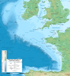
Bathymetric map of the Celtic Sea, part of the Atlantic Ocean, and its surroundings
|
|
| Coordinates | 50°N 8°W / 50°N 8°WCoordinates: 50°N 8°W / 50°N 8°W |
| Type | Sea |
| Basin countries | Ireland, England, Wales, France |
The Celtic Sea (Irish: An Mhuir Cheilteach; Welsh: Y Môr Celtaidd; Cornish: An Mor Keltek; Breton: Ar Mor Keltiek; French: La mer Celtique) is the area of the Atlantic Ocean off the south coast of Ireland bounded to the east by Saint George's Channel; other limits include the Bristol Channel, the English Channel, and the Bay of Biscay, as well as adjacent portions of Wales, Cornwall, Devon, and Brittany. The southern and western boundaries are delimited by the continental shelf, which drops away sharply. The Isles of Scilly are an archipelago of small islands in the sea.
The Celtic Sea takes its name from the Celtic heritage of the bounding lands to the north and east. The name was first proposed by E.W.L. Holt at a 1921 meeting in Dublin of fisheries experts from England, Wales, Ireland, Scotland and France. The northern portion of this sea had previously been considered as part of Saint George's Channel and the southern portion as an undifferentiated part of the "Southwest Approaches" to Britain. The need for a common name came to be felt because of the common marine biology, geology and hydrology. It was adopted in France before being common in the English-speaking countries; in 1957 Édouard Le Danois wrote, "the name Celtic Sea is hardly known even to oceanographers." It was adopted by marine biologists and oceanographers, and later by petroleum exploration firms. It is named in a 1963 British atlas, but a 1972 article states "what British maps call the Western Approaches, and what the oil industry calls the Celtic Sea [...] certainly the residents on the western coast [of Great Britain] don't refer to it as such."
...
Wikipedia
