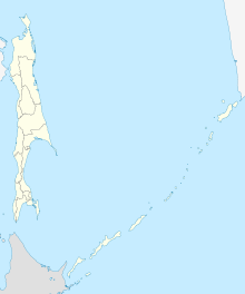
Smirnykh (air base)
| Smirnykh | |||||||||||
|---|---|---|---|---|---|---|---|---|---|---|---|
| Summary | |||||||||||
| Airport type | Military | ||||||||||
| Operator | Soviet Air Force | ||||||||||
| Location | Smirnykh | ||||||||||
| Elevation AMSL | 141 ft / 43 m | ||||||||||
| Coordinates | 49°44′18″N 142°51′36″E / 49.73833°N 142.86000°ECoordinates: 49°44′18″N 142°51′36″E / 49.73833°N 142.86000°E | ||||||||||
| Map | |||||||||||
| Runways | |||||||||||
|
|||||||||||
Smirnykh (Russian: Смирных) is an abandoned Soviet airbase in Sakhalin, Russia located 2 km east of the village of the same name. It appeared in June 1966 KH-7 imagery with a runway length of 2,000 m. It was expanded sometime after this to 2,500 m with a new extension of revetments added.
In October 1972 a US reconnaissance satellite assessment showed 17 Yak-28P Firebar long-range interceptors, 2 Antonov An-24 Coke transports, and 1 Lisunov Li-2 Cab (DC-3 copy) transport.
By the 1980s Smirnykh was home to a MiG-23 (Flogger-G) interceptor regiment An ICAO report on the 1983 downing of Korean Air Flight 007 indicated PVO (Soviet Anti-Air Defense) MiG-23 fighter aircraft from Smirnykh were scrambled, but it was an Su-15 jet from Dolinsk-Sokol which carried out the shootdown.
The airfield is no longer in use and the runways have not been maintained in decades.
...
Wikipedia

