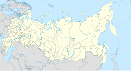
Sakhalin
 |
|
| Geography | |
|---|---|
| Location | Russian Far East, Pacific Ocean |
| Coordinates | 51°N 143°E / 51°N 143°ECoordinates: 51°N 143°E / 51°N 143°E |
| Area | 72,492 km2 (27,989 sq mi) |
| Area rank | 23rd |
| Highest elevation | 1,609 m (5,279 ft) |
| Highest point | Lopatin |
| Administration | |
| Largest settlement | Yuzhno-Sakhalinsk (pop. 174,203) |
| Demographics | |
| Population | 497,973 (2010) |
| Pop. density | 8 /km2 (21 /sq mi) |
| Ethnic groups | Russians, Koreans, Nivkhs, Oroks, Evenks and Yakuts. |
| Yuzhno-Sakhalinsk | ||||||||||||||||||||||||||||||||||||||||||||||||||||||||||||
|---|---|---|---|---|---|---|---|---|---|---|---|---|---|---|---|---|---|---|---|---|---|---|---|---|---|---|---|---|---|---|---|---|---|---|---|---|---|---|---|---|---|---|---|---|---|---|---|---|---|---|---|---|---|---|---|---|---|---|---|---|
| Climate chart () | ||||||||||||||||||||||||||||||||||||||||||||||||||||||||||||
|
||||||||||||||||||||||||||||||||||||||||||||||||||||||||||||
|
||||||||||||||||||||||||||||||||||||||||||||||||||||||||||||
| J | F | M | A | M | J | J | A | S | O | N | D |
|
48
−8
−18
|
44
−7
−19
|
42
−2
−13
|
57
5
−4
|
69
12
1
|
54
16
7
|
87
19
11
|
105
21
12
|
107
18
7
|
98
11
0
|
81
2
−7
|
63
−7
−17
|
| Average max. and min. temperatures in °C | |||||||||||
| Precipitation totals in mm | |||||||||||
| Source: Weather Underground | |||||||||||
| Imperial conversion | |||||||||||
|---|---|---|---|---|---|---|---|---|---|---|---|
| J | F | M | A | M | J | J | A | S | O | N | D |
|
1.9
18
0
|
1.7
19
−2
|
1.7
28
9
|
2.2
41
25
|
2.7
54
34
|
2.1
61
45
|
3.4
66
52
|
4.1
70
54
|
4.2
64
45
|
3.9
52
32
|
3.2
36
19
|
2.5
19
1
|
| Average max. and min. temperatures in °F | |||||||||||
| Precipitation totals in inches | |||||||||||
...
Wikipedia

