Sengkang New Town
| Sengkang | |||||||||
|---|---|---|---|---|---|---|---|---|---|
| Planning Area and HDB Town | |||||||||
| Other transcription(s) | |||||||||
| • Chinese | 盛港 | ||||||||
| • Pinyin | Shèng Gǎng | ||||||||
| • Malay | Sengkang | ||||||||
| • Tamil | செங்காங | ||||||||
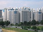
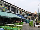
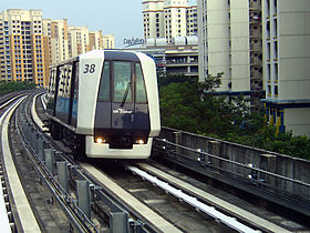
From top left to right: Panoramic view of Sungei Serangoon with Rivervale on the west bank, Compassvale, Jalan Kayu, Sengkang LRT Line, Ranggung LRT Station, Sengkang Sculpture Park, Fernvale Primary School
|
|||||||||
| Location of Sengkang within Singapore | |||||||||
| Coordinates: 1°23′30″N 103°53′40″E / 1.39167°N 103.89444°E | |||||||||
| Country |
|
||||||||
| Region |
|
||||||||
| CDCs | |||||||||
| Town councils |
|
||||||||
| Constituencies | |||||||||
| Government | |||||||||
| • Mayors |
Central Singapore CDC North East CDC |
||||||||
| • Members of Parliament |
Ang Mo Kio GRC Aljunied GRC Pasir Ris-Punggol GRC Punggol East SMC Sengkang West SMC |
||||||||
| Area | |||||||||
| • Total | 10.59 km2 (4.09 sq mi) | ||||||||
| • Residential | 3.97 km2 (1.53 sq mi) | ||||||||
| Population (2015) | |||||||||
| • Total | 206,680 | ||||||||
| • Density | 20,000/km2 (51,000/sq mi) | ||||||||
| Demonym(s) |
Official
Colloquial
|
||||||||
| Postal district | 19 | ||||||||
| Dwelling units | 59,497 | ||||||||
| Projected ultimate | 92,000 | ||||||||
Central Singapore CDC
North East CDC
Ang Mo Kio GRC
Aljunied GRC
Pasir Ris-Punggol GRC
Punggol East SMC
Sengkang West SMC
Official
Colloquial
Sengkang (Chinese: 盛港, Tamil: செங்காங) is a planning area and residential town located in the North-East Region of Singapore. Sengkang shares boundaries with Seletar and Punggol in the north, Pasir Ris and Paya Lebar in the east, Hougang and Serangoon to the south, as well as Yishun and Ang Mo Kio to the west.
Originally a fishing village, the area is undergoing rapid development under the ambition of the Housing and Development Board (HDB) to transform it into a fully mature housing estate. The town is made up of four neighbourhoods.
The name Sengkang means "prosperous harbour" in Chinese. The name comes from a road called Lorong Sengkang, off Lorong Buangkok. The area was formerly known as Kangkar (Gang Jiao 港脚) or "foot of the port" as there was once a fishing port located along Sungei Serangoon. Fishing villages and rubber, pepper and pineapple plantations flourished in the area in the old days.
...
Wikipedia


