Sabine River (Texas–Louisiana)
| Sabine River | |
|
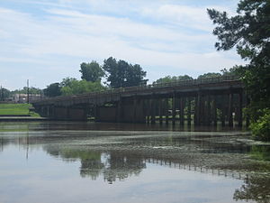
Sabine River at Logansport, Louisiana
|
|
| Country | United States |
|---|---|
| States | Texas, Louisiana |
| Source | Iron Bridge Dam |
| - location | Lake Tawakoni, Van Zandt County, Texas |
| - elevation | 423 ft (129 m) |
| - coordinates | 32°48′29″N 95°55′14″W / 32.80806°N 95.92056°W |
| Mouth | Sabine Lake |
| - location | Texas–Louisiana border, near Orange, Orange County, Texas and Cameron Parish, Louisiana |
| - elevation | 0 ft (0 m) |
| - coordinates | 29°59′08″N 93°47′26″W / 29.98556°N 93.79056°WCoordinates: 29°59′08″N 93°47′26″W / 29.98556°N 93.79056°W |
| Length | 510 mi (821 km) |
| Basin | 9,756 sq mi (25,268 km2) |
| Discharge | |
| - average | 8,400 cu ft/s (238 m3/s) |
|
Sabine River (right) and Neches River (left)
|
|
The Sabine River (/səˈbiːn/) is a river, 510 miles (820 km) long, in the U.S. states of Texas and Louisiana. In its lower course, it forms part of the boundary between the two states and empties into Sabine Lake, an estuary of the Gulf of Mexico. The river formed part of the United States-Mexican as well as the United States-Republic of Texas international boundary during the early 19th century. The upper reaches of the river flow through the prairie country of northeast Texas. Along much of its lower reaches, it flows through pine forests along the Texas-Louisiana border, and the bayou country near the Gulf Coast.
The river drains an area of 9,756 square miles (25,270 km2), of which 7,426 square miles (19,230 km2) is in Texas and 2,330 square miles (6,000 km2) in Louisiana. It flows through an area of abundant rainfall and discharges the largest volume of any river in Texas. The name Sabine (Sp: Río de Sabinas) comes from the Spanish word for cypress, in reference to the extensive growth of bald cypresses along the lower river. The river flows through an important petroleum-producing region, and the lower river near the Gulf is among the most industrialized areas of the southeastern United States. The river was often described as the dividing line between the Old South and the New Southwest.
...
Wikipedia


