Säntis
| Säntis | |
|---|---|

Aerial view of Säntis
|
|
| Highest point | |
| Elevation | 2,502 m (8,209 ft) |
| Prominence | 2,021 m (6,631 ft) (#13 in the Alps) |
| Isolation | 25.7 km (16.0 mi) |
| Listing |
Canton high point Ultra |
| Coordinates | 47°14′57.73″N 9°20′35.92″E / 47.2493694°N 9.3433111°ECoordinates: 47°14′57.73″N 9°20′35.92″E / 47.2493694°N 9.3433111°E |
| Geography | |
| Location | Appenzell Ausserrhoden/Appenzell Innerrhoden/St. Gallen, Switzerland |
| Parent range | Appenzell Alps |
At 2,501.9 metres above sea level, Säntis is the highest mountain in the Alpstein massif of northeastern Switzerland. It is also the culminating point of the whole Appenzell Alps, between Lake Walen and Lake Constance. Shared by three cantons, the mountain is a highly visible landmark thanks to its exposed northerly position within the Alpstein massif. As a consequence, houses called Säntisblick (English: Säntis view) can be found in regions as far away as the Black Forest in Germany. Säntis is among the most prominent summits in the Alps and the most prominent summit in Europe with an observation deck on the top. The panorama from the summit is spectacular. Six countries can be seen if the weather allows: Switzerland, Germany, Austria, Liechtenstein, France, and Italy.
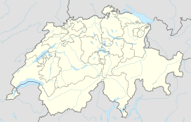
Säntis is located in the Alpstein region, nearly 10 km (as the crow flies) southwest of the town of Appenzell. Three cantons meet on Säntis: Appenzell Ausserrhoden, Appenzell Innerrhoden, and St. Gallen, the mountain being split between the municipalities of Hundwil, Schwende and Wildhaus-Alt St. Johann. Even though its summit is at only 2502 metres above sea level, the mountain ranks number 13th in the Alps and 29th in Europe in topographic prominence at 2021 metres. Peaks with high prominence often have impressive summit views, even if their elevations are relatively modest, Säntis being a prime example. Säntis is also the highest mountain of both cantons of Appenzell Ausserrhoden and Appenzell Innerrhoden.
...
Wikipedia

