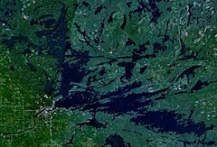
Rainy Lake
| Rainy Lake | |
|---|---|

Rainy Lake from Tango Channel
|
|
 |
|
| Location |
Minnesota, United States; Ontario, Canada |
| Coordinates | 48°38′13″N 93°01′53″W / 48.63694°N 93.03139°WCoordinates: 48°38′13″N 93°01′53″W / 48.63694°N 93.03139°W |
| Type | remnant of former glacial Lake Agassiz |
| Primary inflows | Namakan Lake Kabetogama Lake Seine River |
| Primary outflows | Rainy River |
| Basin countries | Canada, United States |
| Max. length | 80 km (50 mi) |
| Max. width | 48 km (30 mi) |
| Surface area | 932 km2 (360 sq mi) |
| Max. depth | 50 m (160 ft) highly variable |
| Shore length1 | 1,500 km (930 mi) 2,520 km (1,570 mi) (w/ Islands) highly irregular, rocky shoreline |
| Surface elevation | 338 m (1,109 ft) |
| Islands | ~2,568 |
| Settlements |
International Falls, MN Fort Frances, Ontario |
| 1 Shore length is not a well-defined measure. | |
Rainy Lake (French: lac à la Pluie; Ojibwe: gojiji-zaaga'igan) is a relatively large freshwater lake (360 square miles (930 km2)) straddling the border between the United States and Canada. The Rainy River issues from the west side of the lake and is harnessed to make hydroelectricity for US and Canadian locations. The sister cities of International Falls, Minnesota, and Fort Frances, Ontario, are situated on either side of the outflow of the river from the lake. Rainy Lake and Rainy River establish part of the boundary between the U.S. state of Minnesota and the Canadian province of Ontario.
Voyageurs National Park is located on the southeastern corner of the lake, where it connects with Kabetogama and Namakan Lakes at Kettle Falls. Rainy Lake is part of an extremely large system of lakes forming the Hudson Bay drainage basin that stretches from west of Lake Superior north to the Arctic Ocean. The Rainy Lake watershed includes the Boundary Waters Canoe Area Wilderness (BWCA), portions of the Superior National Forest on the US side of the border, and the Quetico Provincial Park on the Canadian side of the border.
For exploration and fur trade history see Winnipeg River and additional references below.
Earliest documentation of the lake's name is "Tekamamiwen" (shown as "Lac de Tecamamiouen" on the Ochagach map (c. 1728), as "Lac Tacamamioüer" on the 1739 de l'Isle map, as "Lake Tecamaniouen" on the 1757 Mitchell Map and as "Lake Tekamamigovouen" on the Thomas Jefferys' 1762 Map of Canada). Pierre Gaultier de Varennes, sieur de La Vérendrye cites that the name was a corruption from the Cree "taki-kimiwen", meaning "It always is raining", referring to the Rainy River, though the language does not quite support that claim. He also cites that the lake was also known as "Ouichichick" (Ojibwe word Gojijiing or Cree Kocicīhk, both meaning "at the place of inlets"). Early documents lists the portion of Rainy Lake east of the Brule Narrows as "Cristinaux [Cree] Lake" or as "Little Lake."
...
Wikipedia

