Putumayo region
| Putumayo River | |
| Río Içá | |
|
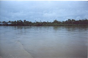
Putumayo at Puerto Asis, Colombia
|
|
| Countries | Brazil, Colombia, Ecuador, Peru |
|---|---|
| Tributaries | |
| - left | Guamués River, San Miguel |
| - right | Cara Paraná |
| Source | Andes Mountains |
| - location | East of Pasto, Colombia |
| - elevation | 6,000 m (19,685 ft) |
| Mouth | Amazon River |
| - location | Santo Antônio do Içá, Brazil |
| - coordinates | 3°8′6″S 67°58′27″W / 3.13500°S 67.97417°WCoordinates: 3°8′6″S 67°58′27″W / 3.13500°S 67.97417°W |
| Length | 1,610 km (1,000 mi) |
| Discharge | |
| - average | 8,760 m3/s (309,356 cu ft/s) |
|
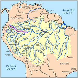
Map of the Amazon Basin with the Putumayo River highlighted in pink
|
|
The Putumayo River or Içá River (Spanish: Río Putumayo, Portuguese: Río Içá) is one of the tributaries of the Amazon River, west of and parallel to the Japurá River.
The Putumayo River forms part of Colombia's border with Ecuador, as well as most of the frontier with Peru. Known as the Putumayo in the former three nations, it is called the Içá when it crosses into Brazil. The Putumayo originates in the Andes Mountains east of the city of Pasto, Colombia. It empties into the Solimões (upper Amazon) near the municipality of Santo Antônio do Içá, Brazil. Major tributaries include the Guamués River, San Miguel, Güeppí, Cumpuya, Algodón, Igara-Paraná, Yaguas, Cotuhé, and Paraná de Jacurapá rivers. The river flows through the Solimões-Japurá moist forests ecoregion.
In the late 19th century, the Içá was navigated by the French explorer Jules Crevaux (1847–1882). He ascended it in a steamer drawing 1.8 metres (6 ft) of water, and running day and night. He reached Cuembí, 1,300 kilometres (800 mi) above its mouth, without finding a single rapid. Cuembí is only 320 kilometres (200 mi) from the Pacific Ocean, in a straight line, passing through the town of Pasto in southern Colombia. Creveaux discovered the river sediments to be free of rock to the base of the Andes; the river banks were of argillaceous earth and the bottom of fine sand.
...
Wikipedia


