Port-aux-Basques, Newfoundland and Labrador
| Channel-Port aux Basques | |
|---|---|
| Town | |

The Channel-Port aux Basques waterfront in October 2005.
|
|
| Location of Channel-Port aux Basques in Newfoundland | |
| Coordinates: 47°34′10″N 59°08′10″W / 47.56944°N 59.13611°WCoordinates: 47°34′10″N 59°08′10″W / 47.56944°N 59.13611°W | |
| Country |
|
| Province |
|
| Incorporated | 1945 |
| Government | |
| • Type | Channel-Port aux Basques Town Council |
| • Mayor | Ralph Pontillas |
| Area | |
| • Total | 38.77 km2 (14.97 sq mi) |
| Elevation | 23 m (75 ft) |
| Population (2011) | |
| • Total | 4,170 |
| • Density | 111.4/km2 (289/sq mi) |
| Time zone | Newfoundland Time (UTC-3:30) |
| • Summer (DST) | Newfoundland Daylight (UTC-2:30) |
| Postal code span | A0M |
| Area code(s) | 709 |
| Highways |
Route 470 Route 1 |
| Website | www |

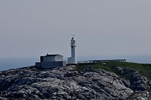
Channel Head Lighthouse
|
|
| Location | Channel Head Channel-Port aux Basques Newfoundland Canada |
|---|---|
| Coordinates | 47°33′57.3″N 59°07′24.8″W / 47.565917°N 59.123556°W |
| Year first constructed | 1875 (first) |
| Year first lit | 1895 (current) |
| Construction | wooden tower (first) cast iron tower (current) |
| Tower shape | square prism tower with balcony and lantern (first) cylindrical tower with balcony and lantern (current) |
| Height | 9 metres (30 ft) (first) 17 metres (56 ft) (current) |
| Focal height | 27.5 metres (90 ft) (first) 29 metres (95 ft) (current) |
| Range | 17 nautical miles (31 km; 20 mi) |
| Characteristic | Fl W 10s. |
| Fog signal | 1 blast every 60s. |
| Admiralty number | H0222 |
| CHS number | CCG 160 |
| NGA number | 2468 |
| ARLHS number | CAN-654 |
| Managing agent | Canadian Coast Guard |
Channel-Port aux Basques is a town at the extreme southwestern tip of Newfoundland fronting on the western end of the Cabot Strait. A Marine Atlantic ferry terminal is located in the town which is the primary entry point onto the island of Newfoundland and the western terminus of the Trans-Canada Highway in the province. The town was incorporated in 1945 and its population in the 2011 census was 4,170.
Port aux Basques is the oldest of the collection of towns that make up the present-day town, which consists of Port aux Basques, Channel, Grand Bay, and Mouse Island. Amalgamation took place in the 1970s.
Channel refers to the narrow channel of water that leads into the local harbour. Port aux Basques refers to the harbour that was a favoured sheltering and watering place for Basque whalers who hailed from the Basque region of the Pyrenees of France and Spain during the early 16th century. After leaving the harbour the whalers either proceeded to the main whaling grounds off southern Labrador, or headed home to the Basque country. They almost certainly took on fresh water from Dead Man's Brook, which flows into Port aux Basques harbour, during their stopovers.
Port aux Basques is first seen on a 1687 Johannes van Keulen map of the area. Permanent settlement came from French fishermen who overwintered on this, the "French shore", using rights given under the 1713 Treaty of Utrecht which saw France cede its claims in Newfoundland to Great Britain in exchange for right of use of coastal lands for the fishery. With the fishery being the economic mainstay for both French and British settlers in the area, Channel-Port aux Basques [6] appeared destined to remain a collection of small fishing villages.
The town is called "Siinalk" in the Mi'kmaq language.
In 1856, an underwater telegraph cable [7] was successfully laid between Newfoundland and Cape Breton Island, making landfall nearby. This was the first step in the race to complete a trans-Atlantic telegraph cable. A telegraph station was opened in Port aux Basques in 1857.
...
Wikipedia

