Newfoundland (island)
| Nickname: "The Rock" | |
|---|---|

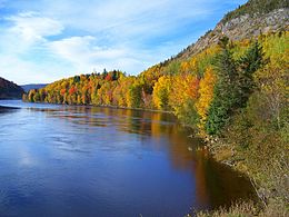
The Humber River on Newfoundland island on an October 2007 autumn day
|
|
| Newfoundland (island) | |
| Geography | |
| Location | Atlantic Ocean |
| Coordinates | 49°N 56°W / 49°N 56°W |
| Area | 108,860 km2 (42,030 sq mi) |
| Area rank | 16th |
| Coastline | 9,656 km (6,000 mi) |
| Highest elevation | 814 m (2,671 ft) |
| Highest point | The Cabox |
| Administration | |
| Province | Newfoundland and Labrador |
| Largest settlement | St. John's (pop. 200,600) |
| Demographics | |
| Population | 479,105 (2006) |
| Pop. density | 4.30 /km2 (11.14 /sq mi) |
| Ethnic groups | English, Irish, French, Scottish and Mi'kmaq |
| Additional information | |
|
Longest River: Exploits River (246 kilometres (153 mi)) Seat of Government: Government of Newfoundland and Labrador <http://www.gov.nl.ca> Members of the Canadian House of Commons: 6 (of 7 in NL and 308 total) Members of the Canadian Senate: 6 (of 6 in NL and 105 total) Members of the Newfoundland and Labrador House of Assembly: 44 (of 48 total)  Flag of Newfoundland and Labrador Flag of the Canadian province of Newfoundland and Labrador (1980 to present) |
|
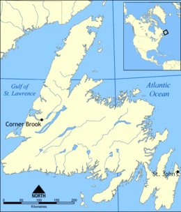
Newfoundland (![]() i/njuːfənˈlænd/ new-fən-LAND;Spanish: Terranova, French: Terre-Neuve, Mi'kmaq: Taqamkuk, Irish: Talamh an Éisc, Inuttitut: Kallunasillik / Ikkarumikluak) is a large Canadian island off the east coast of the North American mainland, and the most populous part of the Canadian province of Newfoundland and Labrador. The island is separated from the Labrador Peninsula by the Strait of Belle Isle and from Cape Breton Island by the Cabot Strait. It blocks the mouth of the Saint Lawrence River, creating the Gulf of Saint Lawrence, the world's largest estuary. Newfoundland's nearest neighbour is the French overseas community of Saint-Pierre and Miquelon.
i/njuːfənˈlænd/ new-fən-LAND;Spanish: Terranova, French: Terre-Neuve, Mi'kmaq: Taqamkuk, Irish: Talamh an Éisc, Inuttitut: Kallunasillik / Ikkarumikluak) is a large Canadian island off the east coast of the North American mainland, and the most populous part of the Canadian province of Newfoundland and Labrador. The island is separated from the Labrador Peninsula by the Strait of Belle Isle and from Cape Breton Island by the Cabot Strait. It blocks the mouth of the Saint Lawrence River, creating the Gulf of Saint Lawrence, the world's largest estuary. Newfoundland's nearest neighbour is the French overseas community of Saint-Pierre and Miquelon.
...
Wikipedia

