Pećinci
|
Pećinci Пећинци |
||
|---|---|---|
| Village and municipality | ||
 |
||
|
||
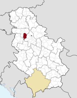
 Location of the municipality of Pećinci within Serbia |
||
| Coordinates: 44°54′N 19°58′E / 44.900°N 19.967°ECoordinates: 44°54′N 19°58′E / 44.900°N 19.967°E | ||
| Country |
|
|
| Province | Vojvodina | |
| District | Srem | |
| Settlements | 15 | |
| Government | ||
| • Mayor | Sava Čojčić | |
| Area | ||
| • Municipality | 489 km2 (189 sq mi) | |
| Population (2011 census) | ||
| • Town | 2,571 | |
| • Municipality | 19,675 | |
| Time zone | CET (UTC+1) | |
| • Summer (DST) | CEST (UTC+2) | |
| Postal code | 22410 | |
| Area code | (+381) 022 | |
| Car plates | RU | |
| Website | www |
|
Pećinci (Serbian Cyrillic: Пећинци, pronounced [pětɕiːntsi]) is a village and municipality located in the Srem District of the autonomous province of Vojvodina, Serbi. The village has a population of 2,571 (2011), while Pećinci municipality has 19,675 inhabitants.
In Serbian, the village is known as Pećinci (Пећинци), in Croatian as Pećinci, in Hungarian as Pecsince, in German as Petschinzi, in Slovak as Pečinci, and in Rusyn as Печинци. Its name derived from the Serbian word "peć/пећ" ("furnace" in English), or "petlja/петља" ("loop" or "noose" in English).
The village was first time recorded by the sources in 1416. After that time, there were no other records about this settlement until 1702. The village was under Ottoman administration until the Treaty of Passarowitz (1718), when it passed to Habsburg Monarchy. During Habsburg administration, it was part of the Habsburg Military Frontier. From 1848 to 1849, the village was part of Serbian Vojvodina, but was again included into Military Frontier in 1849. After abolishment of the frontier (in 1882), it was included into Syrmia County of Croatia-Slavonia, which was an autonomous kingdom within the Kingdom of Hungary and Austria-Hungary. According to 1910 census, the village had Serb ethnic majority.
...
Wikipedia

