Norfolk Island Airport
| Norfolk Island Airport | |||||||||||||||
|---|---|---|---|---|---|---|---|---|---|---|---|---|---|---|---|
 |
|||||||||||||||
| Summary | |||||||||||||||
| Airport type | Public | ||||||||||||||
| Owner | Government of Norfolk Island | ||||||||||||||
| Operator | Administration of Norfolk Island | ||||||||||||||
| Serves | Norfolk Island | ||||||||||||||
| Elevation AMSL | 371 ft / 113 m | ||||||||||||||
| Coordinates | 29°02′33″S 167°56′17″E / 29.04250°S 167.93806°ECoordinates: 29°02′33″S 167°56′17″E / 29.04250°S 167.93806°E | ||||||||||||||
| Website | www.airport.gov.nf | ||||||||||||||
| Map | |||||||||||||||
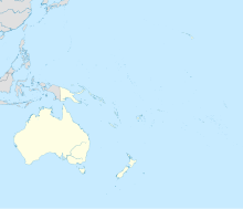
| Location of airport on map of Oceania | |||||||||||||||
| Runways | |||||||||||||||
|
|||||||||||||||
| Statistics (2010/11) | |||||||||||||||
|
|||||||||||||||
|
Sources: Australian AIP and aerodrome chart
Passenger and aircraft movements from the Bureau of Infrastructure, Transport and Regional Economics (BITRE) |
|||||||||||||||
| Passengers | 57,758 |
|---|---|
| Aircraft movements | 872 |
Norfolk Island Airport (IATA: NLK, ICAO: YSNF), also referred to as Norfolk Island International Airport, is the only airport on Norfolk Island, an external territory of Australia. The island is located in the Pacific Ocean between Australia, New Zealand, and New Caledonia. The airport is operated by the Administration of Norfolk Island, and is on the west side of the island.
The airstrip was built by the United States Army Air Forces during World War II as a defensive measure to counter feared Japanese operations in the South Pacific. As Norfolk Island did not have enough flat ground, in 1942 several bulldozers were used to knock the tops off several hills, and fill in the valleys between them. Steel mesh was then used to make a solid surface.
Initially used for bomber patrols and for a transport service to Bougainville Island, the airfield was never used as a major base and became a stopover for aircraft travelling between Australia, New Caledonia, New Zealand and the Solomon Islands. The Royal New Zealand Air Force left the airfield in July 1946. At the airfield was an air-sea rescue unit, a servicing section and a radar unit installation at Mount Bates.
Norfolk Island is an important transit and refueling point for light aircraft flying between Australia, New Zealand, and the Pacific Islands.
Located 852 km (529 mi) southeast of Norfolk is Kaitaia Airport the most northerly airfield in New Zealand, 754 km (469 mi) north is Nouméa Airport in New Caledonia, and 900 km (560 mi) west is Lord Howe Island Airport which is 600 km (370 mi) to the Australian mainland.
...
Wikipedia

