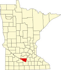
Nicollet County
| Nicollet County, Minnesota | |
|---|---|

Nicollet County Courthouse
|
|
 Location in the U.S. state of Minnesota |
|
 Minnesota's location in the U.S. |
|
| Founded | March 5, 1853 |
| Named for | Joseph Nicolas Nicollet |
| Seat | St. Peter |
| Largest city | North Mankato |
| Area | |
| • Total | 467 sq mi (1,210 km2) |
| • Land | 448 sq mi (1,160 km2) |
| • Water | 18 sq mi (47 km2), 3.9% |
| Population (est.) | |
| • (2016) | 33,575 |
| • Density | 66/sq mi (25/km²) |
| Congressional district | 1st |
| Time zone | Central: UTC-6/-5 |
| Website | www |
Nicollet County is a county in the U.S. state of Minnesota. It was named for French geographer Joseph N. Nicollet. As of the 2010 census, the population was 32,727. Its county seat is St. Peter.
Nicollet County is part of the Mankato–North Mankato, MN Metropolitan Statistical Area.
According to the U.S. Census Bureau, the county has an area of 467 square miles (1,210 km2), of which 448 square miles (1,160 km2) is land and 18 square miles (47 km2) (3.9%) is water.
Nicollet County's highest point is the lowest high point of all Minnesota counties, with an elevation of 1,065 feet. The county's high point is east of Clear Lake and west of the town of Lafayette.
As of the 2000 census, there were 29,771 people, 10,642 households, and 7,311 families residing in the county. The population density was 66 people per square mile (25/km²). There were 11,240 housing units at an average density of 25 per square mile (10/km²). The racial makeup of the county was 96.37% White, 0.80% Black or African American, 0.26% Native American, 1.14% Asian, 0.02% Pacific Islander, 0.65% from other races, and 0.75% from two or more races. 1.80% of the population were Hispanic or Latino of any race. 49.2% were of German, 13.3% Norwegian, 6.8% Swedish and 5.4% Irish ancestry.
...
Wikipedia
